Kamyshin night lights from space
Night Light of Kamyshin (Volgograd Oblast) from space (Russia) Src. Average luminocity for 10x10km area is 36.266% and for 50x50km: 1.9351%.
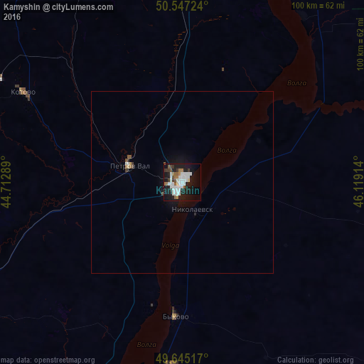
Analysis of Kamyshin night lights 2016
Square area 10x10 km:
 10.29%
90-99
10.43%80-89
0.67%70-79
0.94%60-69
4.14%50-59
4.14%40-49
1.34%30-39
4.41%20-29
7.89%10-19
33.56%0-9
22.19%Square area 50x50 km:
0.44%90-99
0.46%80-89
0.06%70-79
0.06%60-69
0.21%50-59
0.25%40-49
0.12%30-39
0.23%20-29
0.37%10-19
1.87%0-9
95.94%Clear (daylight) street map image can be seen on geolist.org.
Map coordinates:
50° 32' 50.1" North, 44° 42' 46.4" East
50° 5' 54" North, 45° 24' 57.6" East
49° 38' 42.6" North, 46° 7' 8.9" East
Some cities around Kamyshin sort by population:
• Kotovo
50.3 km =31.3 mi,  299°
299°
• Nikolayevsk
8.4 km =5.2 mi,  158°
158°
• Petrov Val
15.5 km =9.6 mi,  288°
288°
• Bykovo
37 km =23 mi,  183°
183°
• Rudnya
98.8 km =61.4 mi,  322°
322°
• Krasnyy Yar
82.5 km =51.3 mi, 323°
• Danilovka
96.7 km =60.1 mi, 287°
• Rovnoye
87.8 km =54.6 mi,  30°
30°
553287 (p: 128,626)
Sources (retrieved 2019-11-25):
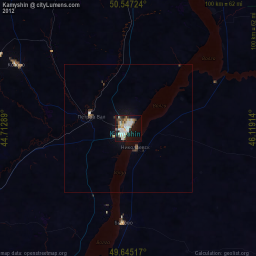
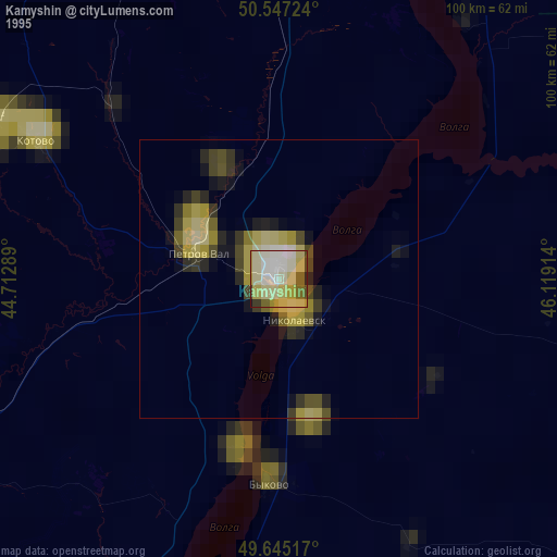
» NASA, Earths city lights 1995
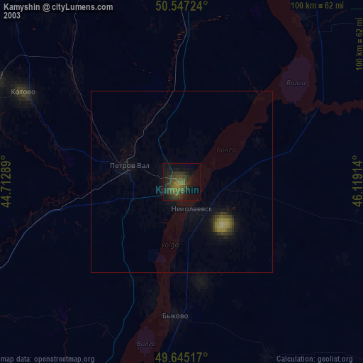
» NASA city lights 2003
» Earth at Night: Flat Maps 2012, 2016