Kalashnikovo night lights from space
Night Light of Kalashnikovo (Tver’ Oblast) from space (Russia) Src. Average luminocity for 10x10km area is 0.9795% and for 50x50km: 0.7704%.
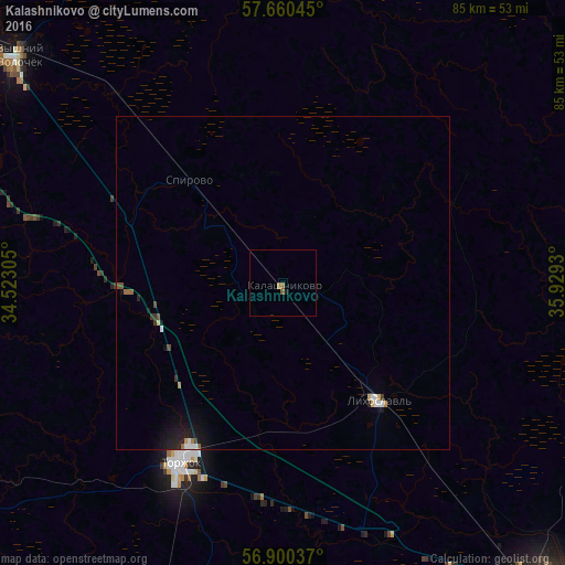
Analysis of Kalashnikovo night lights 2016
Square area 10x10 km:
 0%
0%90-99
0%80-89
0%70-79
0.11%60-69
0.68%50-59
0.57%40-49
0%30-39
0%20-29
0.45%10-19
0%0-9
98.18%Square area 50x50 km:
0.12%90-99
0.09%80-89
0.07%70-79
0.04%60-69
0.13%50-59
0.07%40-49
0.09%30-39
0.11%20-29
0.17%10-19
0.77%0-9
98.35%Clear (daylight) street map image can be seen on geolist.org.
Map coordinates:
57° 39' 37.6" North, 34° 31' 23" East
57° 16' 56.5" North, 35° 13' 34.2" East
56° 54' 1.3" North, 35° 55' 45.5" East
Some cities around Kalashnikovo sort by population:
• Tver
62.3 km =38.7 mi,  139°
139°
• Vyshniy Volochëk
52.4 km =32.6 mi,  310°
310°
• Torzhok
31 km =19.3 mi,  210°
210°
• Udomlya
67.8 km =42.1 mi,  348°
348°
• Likhoslavl’
22.4 km =13.9 mi, 140°
• Maksatikha
69.3 km =43.1 mi,  34°
34°
• Spirovo
21.3 km =13.2 mi,  315°
315°
• Krasnomayskiy
61.6 km =38.3 mi, 307°
554363 (p: 5,032)
Sources (retrieved 2019-11-25):
» Earth at Night: Flat Maps 2012, 2016