Iskateley night lights from space
Night Light of Iskateley (Nenets) from space (Russia) Src. Average luminocity for 10x10km area is 14.1315% and for 50x50km: 1.1493%.
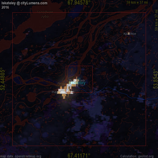
Analysis of Iskateley night lights 2016
Square area 10x10 km:
 3.41%
3.41%90-99
2.68%80-89
0.65%70-79
0.89%60-69
3%50-59
1.46%40-49
1.38%30-39
0.49%20-29
1.3%10-19
13.72%0-9
71.02%Square area 50x50 km:
0.22%90-99
0.2%80-89
0.08%70-79
0.07%60-69
0.24%50-59
0.07%40-49
0.09%30-39
0.03%20-29
0.12%10-19
1.43%0-9
97.44%Clear (daylight) street map image can be seen on geolist.org.
Map coordinates:
67° 56' 44.8" North, 52° 26' 53" East
67° 40' 48.9" North, 53° 9' 4.2" East
67° 24' 42.2" North, 53° 51' 15.5" East
Some cities around Iskateley sort by population:
• Ukhta
458 km =284.6 mi,  176°
176°
• Pechora
334.8 km =208 mi,  147°
147°
• Usinsk
267.8 km =166.4 mi,  134°
134°
• Sosnogorsk
454.7 km =282.5 mi, 175°
• Vorgashor
449.9 km =279.6 mi,  91°
91°
• Nar'yan-Mar
7.8 km =4.8 mi,  233°
233°
• Nizhniy Odes
455.4 km =283 mi,  170°
170°
• Ust-Tsilma
252.9 km =157.1 mi,  190°
190°
866062 (p: 6,545)
Sources (retrieved 2019-11-25):
» Earth at Night: Flat Maps 2012, 2016