Dorogomilovo night lights from space
Night Light of Dorogomilovo (Moscow Oblast) from space (Russia) Src. Average luminocity for 10x10km area is 99.933% and for 50x50km: 85.2%.
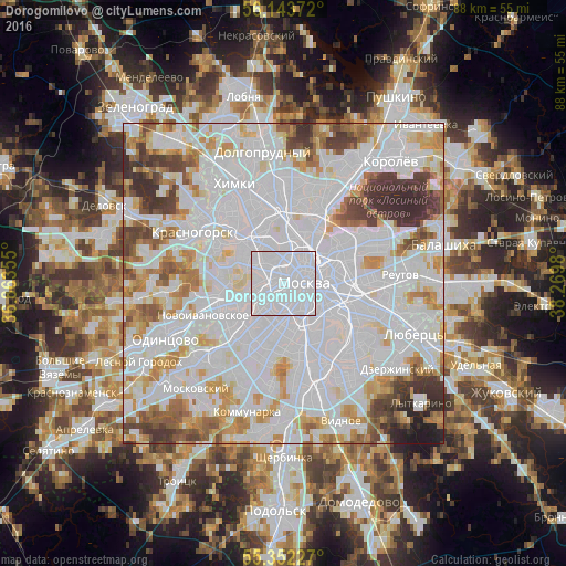
Analysis of Dorogomilovo night lights 2016
Square area 10x10 km:
 97.01%
90-99
2.99%80-89
0%70-79
0%60-69
0%50-59
0%40-49
0%30-39
0%20-29
0%10-19
0%0-9
0%Square area 50x50 km:
44.93%90-99
20.41%80-89
6.18%70-79
6.64%60-69
5.84%50-59
4.19%40-49
4.28%30-39
4.58%20-29
2.32%10-19
0.63%0-9
0%Clear (daylight) street map image can be seen on geolist.org.
Map coordinates:
56° 8' 37.4" North, 36° 51' 48.8" East
55° 45' 0" North, 37° 34' 0" East
55° 21' 8.2" North, 38° 16' 11.3" East
Some cities around Dorogomilovo sort by population:
• Moscow
3.1 km =1.9 mi,  85°
85°
• Presnenskiy
1 km =0.6 mi,  270°
270°
• Fili
5.4 km =3.4 mi, 267°
• Zamoskvorech’ye
4.6 km =2.9 mi,  113°
113°
• Leninskiye Gory
5.6 km =3.5 mi,  180°
180°
• Vorob’yovo
4.3 km =2.7 mi,  209°
209°
• Luzhniki
3.9 km =2.4 mi,  192°
192°
• Kastanayevo
5.6 km =3.5 mi,  228°
228°
565197 (p: 68,000)
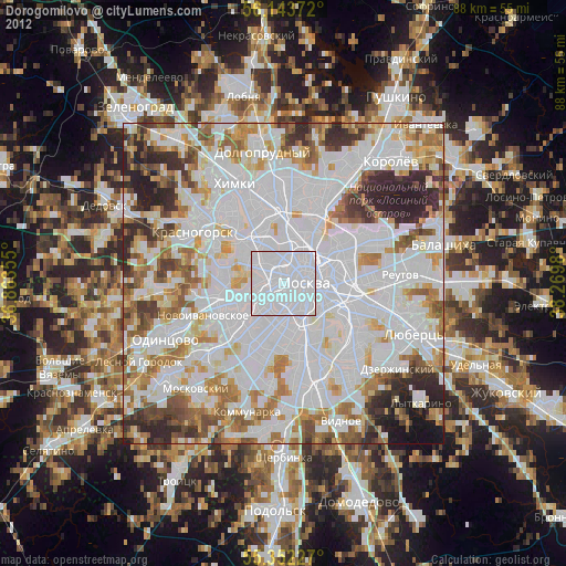
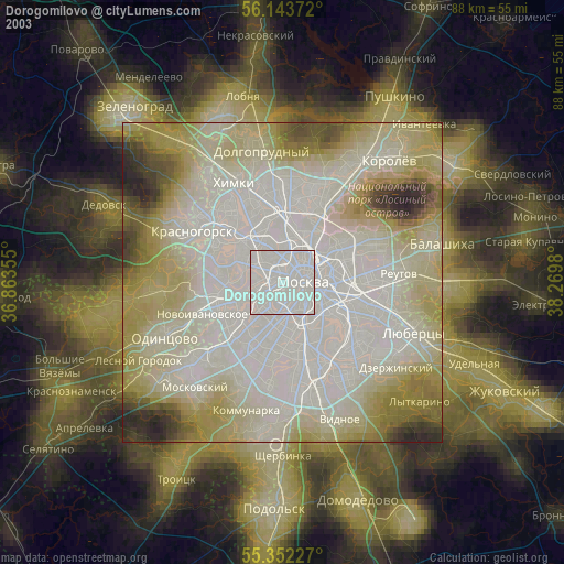
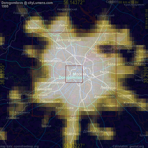
Sources (retrieved 2019-11-25):
» NASA, Earths city lights 1995
» NASA city lights 2003
» Earth at Night: Flat Maps 2012, 2016