Fili night lights from space
Night Light of Fili (Moscow Oblast) from space (Russia) Src. Average luminocity for 10x10km area is 98.561% and for 50x50km: 84.2955%.
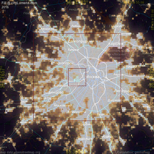
Analysis of Fili night lights 2016
Square area 10x10 km:
 76.08%
90-99
17.94%80-89
5.86%70-79
0.12%60-69
0%50-59
0%40-49
0%30-39
0%20-29
0%10-19
0%0-9
0%Square area 50x50 km:
43.27%90-99
19.81%80-89
6.24%70-79
6.92%60-69
6.57%50-59
5.13%40-49
4.81%30-39
4.25%20-29
2.23%10-19
0.68%0-9
0.09%Clear (daylight) street map image can be seen on geolist.org.
Map coordinates:
56° 8' 30.9" North, 36° 46' 35.7" East
55° 44' 53.5" North, 37° 28' 46.9" East
55° 21' 1.6" North, 38° 10' 58.2" East
Some cities around Fili sort by population:
• Khoroshëvo-Mnevniki
4 km =2.5 mi,  352°
352°
• Presnenskiy
4.4 km =2.7 mi,  87°
87°
• Vorob’yovo
4.9 km =3 mi,  136°
136°
• Matveyevskoye
4.1 km =2.5 mi,  184°
184°
• Davydkovo
3.4 km =2.1 mi,  187°
187°
• Setun’
5.3 km =3.3 mi,  228°
228°
• Bol’shaya Setun’
5.3 km =3.3 mi, 228°
• Kastanayevo
3.7 km =2.3 mi,  160°
160°
562820 (p: 80,000)
Sources (retrieved 2019-11-25):
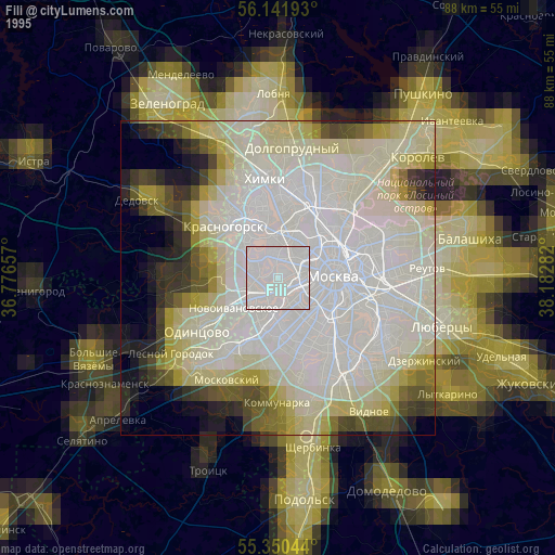
» NASA, Earths city lights 1995
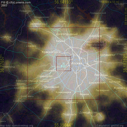
» NASA city lights 2003
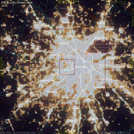
» Earth at Night: Flat Maps 2012, 2016