Nal’chik night lights from space
Night Light of Nal’chik (Kabardino-Balkariya Republic) from space (Russia) Src. Average luminocity for 10x10km area is 60.4556% and for 50x50km: 5.741%.
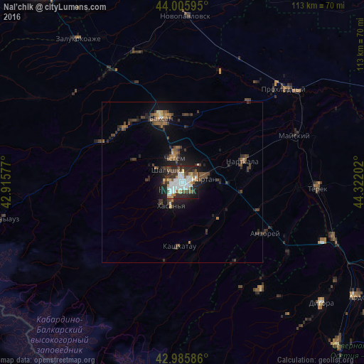
Analysis of Nal’chik night lights 2016
Square area 10x10 km:
 19.52%
90-99
14.29%80-89
5.71%70-79
4.6%60-69
3.97%50-59
7.62%40-49
5.71%30-39
9.52%20-29
20.16%10-19
8.73%0-9
0.16%Square area 50x50 km:
0.78%90-99
0.65%80-89
0.4%70-79
0.39%60-69
0.65%50-59
0.99%40-49
1.41%30-39
1.41%20-29
2.06%10-19
3.87%0-9
87.39%Clear (daylight) street map image can be seen on geolist.org.
Map coordinates:
44° 0' 21.4" North, 42° 54' 56.8" East
43° 29' 53" North, 43° 37' 8" East
42° 59' 9.1" North, 44° 19' 19.3" East
Some cities around Nal’chik sort by population:
• Chegem
7.1 km =4.4 mi,  342°
342°
• Nartan
6.6 km =4.1 mi,  77°
77°
• Shalushka
5.7 km =3.5 mi,  311°
311°
• Chegem Vtoroy
11 km =6.8 mi,  351°
351°
• Kenzhe
5 km =3.1 mi,  274°
274°
• Psygansu
16.6 km =10.3 mi,  121°
121°
• Staryy Cherek
18.6 km =11.6 mi,  99°
99°
• Urvan’
11.4 km =7.1 mi,  93°
93°
523523 (p: 272,800)
Sources (retrieved 2019-11-25):
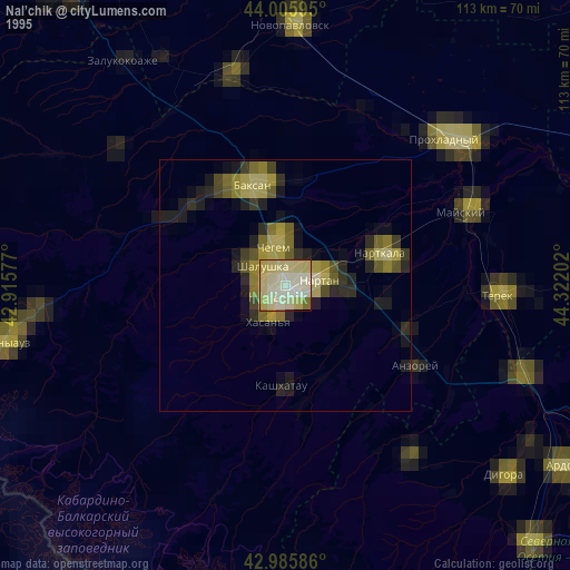
» NASA, Earths city lights 1995
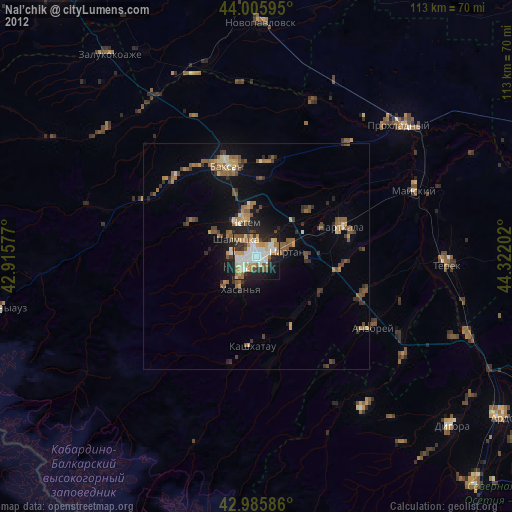
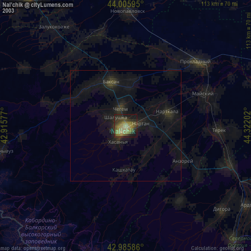
» NASA city lights 2003
» Earth at Night: Flat Maps 2012, 2016