Chechen-Aul night lights from space
Night Light of Chechen-Aul (Chechnya) from space (Russia) Src. Average luminocity for 10x10km area is 21.1106% and for 50x50km: 20.6775%.
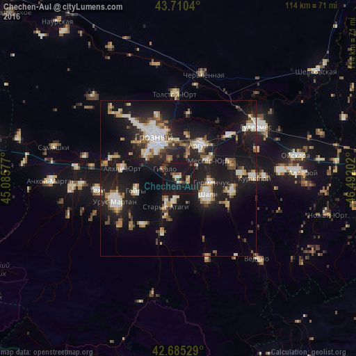
Analysis of Chechen-Aul night lights 2016
Square area 10x10 km:
 0.61%
0.61%90-99
1.21%80-89
1.97%70-79
3.48%60-69
1.97%50-59
1.97%40-49
4.09%30-39
2.73%20-29
3.79%10-19
68.94%0-9
9.24%Square area 50x50 km:
2.82%90-99
3.77%80-89
2.1%70-79
1.92%60-69
2.31%50-59
2.6%40-49
2.11%30-39
2.3%20-29
5.97%10-19
25.08%0-9
49.01%Clear (daylight) street map image can be seen on geolist.org.
Map coordinates:
43° 42' 37.4" North, 45° 5' 8.8" East
43° 12' 0" North, 45° 47' 20" East
42° 41' 7" North, 46° 29' 31.3" East
Some cities around Chechen-Aul sort by population:
• Argun
12.8 km =8 mi,  32°
32°
• Shali
10.8 km =6.7 mi,  122°
122°
• Mesker-Yurt
11.2 km =7 mi,  59°
59°
• Staryye Atagi
9.7 km =6 mi,  203°
203°
• Germenchuk
10.8 km =6.7 mi,  98°
98°
• Novyye Atagi
7.3 km =4.5 mi,  190°
190°
• Khankala
11.7 km =7.3 mi,  346°
346°
• Chiri-Yurt
12.9 km =8 mi, 196°
569666 (p: 7,134)
Sources (retrieved 2019-11-25):
» Earth at Night: Flat Maps 2012, 2016