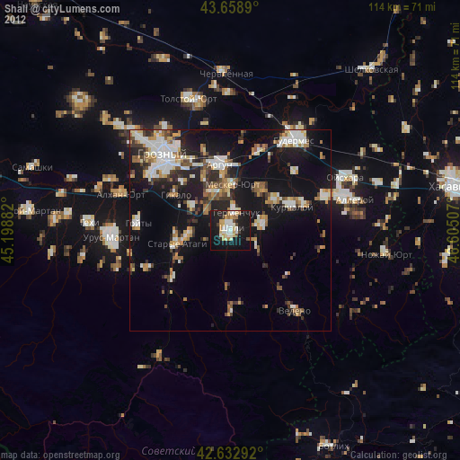
Shali night lights from space
Night Light of Shali (Chechnya) from space (Russia) Src. Average luminocity for 10x10km area is 37.4% and for 50x50km: 18.8231%.
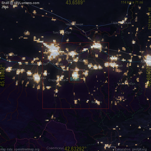
Analysis of Shali night lights 2016
Square area 10x10 km:
 6.67%
6.67%90-99
7.73%80-89
4.7%70-79
2.73%60-69
4.7%50-59
4.7%40-49
2.12%30-39
3.33%20-29
12.42%10-19
44.24%0-9
6.67%Square area 50x50 km:
2.71%90-99
3.64%80-89
1.95%70-79
1.55%60-69
2.1%50-59
2.52%40-49
2.03%30-39
2.17%20-29
4.75%10-19
21.53%0-9
55.04%Clear (daylight) street map image can be seen on geolist.org.
Map coordinates:
43° 39' 32" North, 45° 11' 55.8" East
43° 8' 53" North, 45° 54' 7" East
42° 37' 58.5" North, 46° 36' 18.3" East
Some cities around Shali sort by population:
• Avtury
8.3 km =5.2 mi,  78°
78°
• Tsotsin-Yurt
13.1 km =8.1 mi,  37°
37°
• Mesker-Yurt
11.5 km =7.1 mi,  2°
2°
• Staryye Atagi
13.5 km =8.4 mi,  256°
256°
• Germenchuk
4.5 km =2.8 mi,  20°
20°
• Novyye Atagi
10.6 km =6.6 mi, 262°
• Chechen-Aul
10.8 km =6.7 mi,  302°
302°
• Chiri-Yurt
14.5 km =9 mi,  242°
242°
495957 (p: 25,000)
Sources (retrieved 2019-11-25):
» Earth at Night: Flat Maps 2012, 2016