Chapayevsk night lights from space
Night Light of Chapayevsk (Samara Oblast) from space (Russia) Src. Average luminocity for 10x10km area is 19.8624% and for 50x50km: 6.0756%.
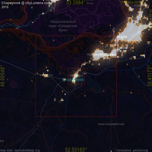
Analysis of Chapayevsk night lights 2016
Square area 10x10 km:
 1.72%
1.72%90-99
4.1%80-89
1.85%70-79
3.84%60-69
1.46%50-59
2.78%40-49
3.31%30-39
1.98%20-29
1.19%10-19
18.39%0-9
59.39%Square area 50x50 km:
1.18%90-99
1.35%80-89
0.33%70-79
0.57%60-69
0.56%50-59
0.76%40-49
0.6%30-39
0.8%20-29
2.35%10-19
3.68%0-9
87.83%Clear (daylight) street map image can be seen on geolist.org.
Map coordinates:
53° 23' 54.2" North, 49° 0' 19.7" East
52° 58' 37.6" North, 49° 42' 31" East
52° 33' 5.9" North, 50° 24' 42.2" East
Some cities around Chapayevsk sort by population:
• Samara
38.5 km =23.9 mi,  49°
49°
• Novokuybyshevsk
20.7 km =12.9 mi, 50°
• Zhigulevsk
49.1 km =30.5 mi,  343°
343°
• Bezenchuk
18.4 km =11.4 mi,  271°
271°
• Roschinskiy
53.4 km =33.2 mi,  81°
81°
• Smyshlyayevka
54.1 km =33.6 mi,  57°
57°
• Krasnoarmeyskoye
35.9 km =22.3 mi,  142°
142°
• Rozhdestveno
37.2 km =23.1 mi,  38°
38°
569955 (p: 70,147)
Sources (retrieved 2019-11-25):
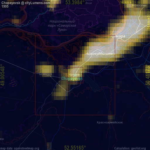
» NASA, Earths city lights 1995
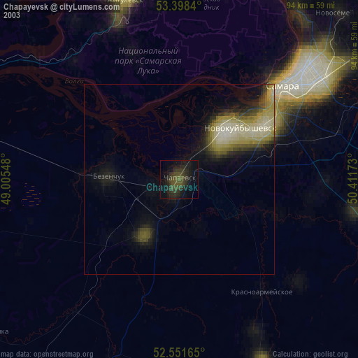
» NASA city lights 2003
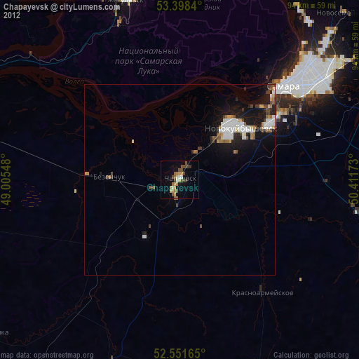
» Earth at Night: Flat Maps 2012, 2016