Bryansk night lights from space
Night Light of Bryansk (Bryansk Oblast) from space (Russia) Src. Average luminocity for 10x10km area is 54.1856% and for 50x50km: 4.7075%.
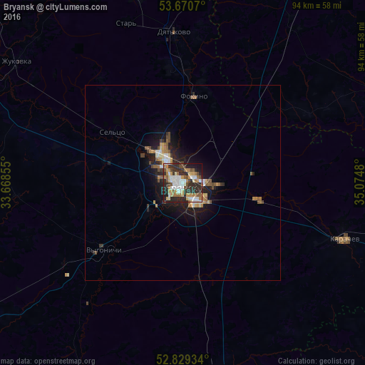
Analysis of Bryansk night lights 2016
Square area 10x10 km:
 8.71%
8.71%90-99
12.75%80-89
5.56%70-79
8.21%60-69
9.72%50-59
4.92%40-49
6.06%30-39
8.08%20-29
25.76%10-19
9.85%0-9
0.38%Square area 50x50 km:
0.49%90-99
0.83%80-89
0.45%70-79
0.64%60-69
0.77%50-59
0.64%40-49
0.64%30-39
0.57%20-29
1.78%10-19
3.48%0-9
89.71%Clear (daylight) street map image can be seen on geolist.org.
Map coordinates:
53° 40' 14.5" North, 33° 40' 6.8" East
53° 15' 7.5" North, 34° 22' 18" East
52° 49' 45.6" North, 35° 4' 29.3" East
Some cities around Bryansk sort by population:
• Dyat’kovo
38.5 km =23.9 mi,  356°
356°
• Karachev
43.3 km =26.9 mi,  109°
109°
• Sel’tso
22 km =13.7 mi,  305°
305°
• Belyye Berega
20.1 km =12.5 mi,  103°
103°
• Suponevo
7.3 km =4.5 mi,  223°
223°
• Rzhanitsa
35.7 km =22.2 mi,  303°
303°
• Lyubokhna
28 km =17.4 mi,  2°
2°
• Vygonichi
26.5 km =16.5 mi,  229°
229°
571476 (p: 427,236)
Sources (retrieved 2019-11-25):
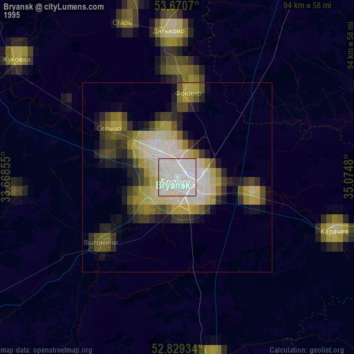
» NASA, Earths city lights 1995
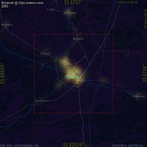
» NASA city lights 2003
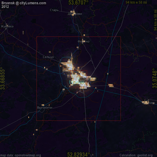
» Earth at Night: Flat Maps 2012, 2016