Rzhanitsa night lights from space
Night Light of Rzhanitsa (Bryansk Oblast) from space (Russia) Src. Average luminocity for 10x10km area is 0% and for 50x50km: 0.9918%.
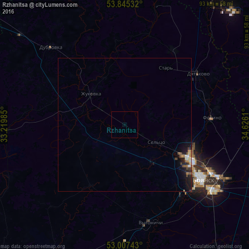
Analysis of Rzhanitsa night lights 2016
Square area 10x10 km:
 0%
0%90-99
0%80-89
0%70-79
0%60-69
0%50-59
0%40-49
0%30-39
0%20-29
0%10-19
0%0-9
100%Square area 50x50 km:
0.04%90-99
0.18%80-89
0.07%70-79
0.14%60-69
0.15%50-59
0.12%40-49
0.18%30-39
0.12%20-29
0.35%10-19
1.07%0-9
97.57%Clear (daylight) street map image can be seen on geolist.org.
Map coordinates:
53° 50' 43.2" North, 33° 13' 11.5" East
53° 25' 42.4" North, 33° 55' 22.7" East
53° 0' 26.7" North, 34° 37' 34" East
Some cities around Rzhanitsa sort by population:
• Bryansk
35.7 km =22.2 mi,  123°
123°
• Dyat’kovo
33.3 km =20.7 mi,  55°
55°
• Zhukovka
17.4 km =10.8 mi,  312°
312°
• Sel’tso
13.7 km =8.5 mi, 119°
• Suponevo
35.1 km =21.8 mi,  135°
135°
• Ivot
32.6 km =20.3 mi,  32°
32°
• Lyubokhna
31.9 km =19.8 mi,  74°
74°
• Vygonichi
37.9 km =23.5 mi,  165°
165°
499778 (p: 5,281)
Sources (retrieved 2019-11-25):
» Earth at Night: Flat Maps 2012, 2016