Vygonichi night lights from space
Night Light of Vygonichi (Bryansk Oblast) from space (Russia) Src. Average luminocity for 10x10km area is 0.8836% and for 50x50km: 3.4815%.
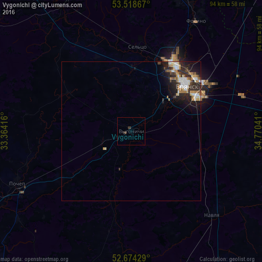
Analysis of Vygonichi night lights 2016
Square area 10x10 km:
 0%
0%90-99
0%80-89
0%70-79
0%60-69
0%50-59
0.26%40-49
0.26%30-39
1.06%20-29
0.53%10-19
0%0-9
97.88%Square area 50x50 km:
0.45%90-99
0.75%80-89
0.35%70-79
0.5%60-69
0.48%50-59
0.32%40-49
0.4%30-39
0.49%20-29
1.49%10-19
2.13%0-9
92.64%Clear (daylight) street map image can be seen on geolist.org.
Map coordinates:
53° 31' 7.2" North, 33° 21' 51" East
53° 5' 54.8" North, 34° 4' 2.2" East
52° 40' 27.4" North, 34° 46' 13.5" East
Some cities around Vygonichi sort by population:
• Bryansk
26.5 km =16.5 mi,  49°
49°
• Sel’tso
30.1 km =18.7 mi,  4°
4°
• Pochep
45.4 km =28.2 mi,  246°
246°
• Navlya
42 km =26.1 mi,  136°
136°
• Belyye Berega
41.6 km =25.8 mi,  72°
72°
• Suponevo
19.3 km =12 mi, 52°
• Rzhanitsa
37.9 km =23.5 mi,  345°
345°
• Lyubokhna
49.8 km =30.9 mi,  25°
25°
470473 (p: 5,086)
Sources (retrieved 2019-11-25):
» Earth at Night: Flat Maps 2012, 2016