Altud night lights from space
Night Light of Altud (Kabardino-Balkariya Republic) from space (Russia) Src. Average luminocity for 10x10km area is 1.2697% and for 50x50km: 2.9941%.
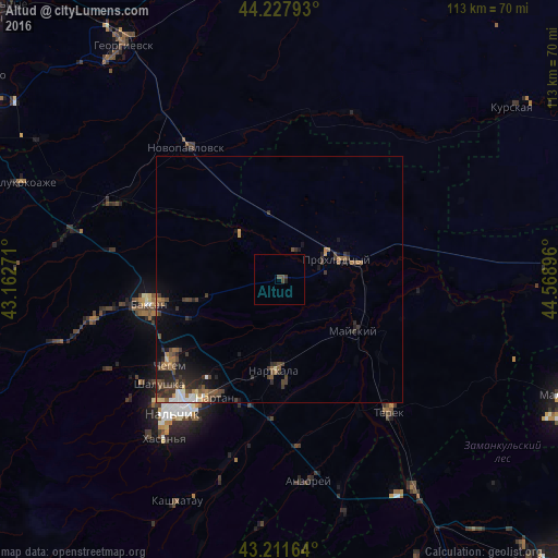
Analysis of Altud night lights 2016
Square area 10x10 km:
 0%
0%90-99
0%80-89
0%70-79
0%60-69
0%50-59
0%40-49
1.82%30-39
0.61%20-29
0.45%10-19
0.15%0-9
96.97%Square area 50x50 km:
0.3%90-99
0.17%80-89
0.19%70-79
0.26%60-69
0.45%50-59
0.64%40-49
0.88%30-39
1.02%20-29
0.99%10-19
1.6%0-9
93.49%Clear (daylight) street map image can be seen on geolist.org.
Map coordinates:
44° 13' 40.5" North, 43° 9' 45.8" East
43° 43' 19" North, 43° 51' 57" East
43° 12' 41.9" North, 44° 34' 8.3" East
Some cities around Altud sort by population:
• Prokhladnyy
13.7 km =8.5 mi,  73°
73°
• Baksan
26.7 km =16.6 mi,  261°
261°
• Nartkala
18.3 km =11.4 mi,  183°
183°
• Chegem Vtoroy
25.6 km =15.9 mi,  236°
236°
• Kakhun
19.9 km =12.4 mi, 177°
• Baksanenok
17.3 km =10.7 mi, 258°
• Karagach
11.8 km =7.3 mi,  321°
321°
• Urvan’
26.9 km =16.7 mi,  198°
198°
582362 (p: 5,578)
Sources (retrieved 2019-11-25):
» Earth at Night: Flat Maps 2012, 2016