Alkhan-Churt night lights from space
Night Light of Alkhan-Churt (Ingushetiya Republic) from space (Russia) Src. Average luminocity for 10x10km area is 7.7952% and for 50x50km: 14.29%.
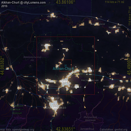
Analysis of Alkhan-Churt night lights 2016
Square area 10x10 km:
 0%
0%90-99
0.95%80-89
0.16%70-79
1.43%60-69
0.95%50-59
0.79%40-49
0.16%30-39
0.95%20-29
0.32%10-19
9.68%0-9
84.6%Square area 50x50 km:
2.37%90-99
3.26%80-89
1.22%70-79
1.14%60-69
1.11%50-59
1.29%40-49
1.37%30-39
1.65%20-29
3.8%10-19
15.05%0-9
67.74%Clear (daylight) street map image can be seen on geolist.org.
Map coordinates:
43° 51' 39.8" North, 44° 5' 1.8" East
43° 21' 7" North, 44° 47' 13" East
42° 50' 18.6" North, 45° 29' 24.3" East
Some cities around Alkhan-Churt sort by population:
• Nazran’
14.1 km =8.8 mi,  184°
184°
• Karabulak
10.5 km =6.5 mi,  119°
119°
• Ekazhevo
15.8 km =9.8 mi,  169°
169°
• Troitskaya
16.7 km =10.4 mi,  107°
107°
• Kantyshevo
18.5 km =11.5 mi,  222°
222°
• Verkhniye Achaluki
7.3 km =4.5 mi,  265°
265°
• Nizhniye Achaluki
6.1 km =3.8 mi,  338°
338°
• Magas
14.4 km =8.9 mi, 184°
802799 (p: 7,666)
Sources (retrieved 2019-11-25):
» Earth at Night: Flat Maps 2012, 2016