Troitskaya night lights from space
Night Light of Troitskaya (Ingushetiya Republic) from space (Russia) Src. Average luminocity for 10x10km area is 29.6621% and for 50x50km: 11.8442%.
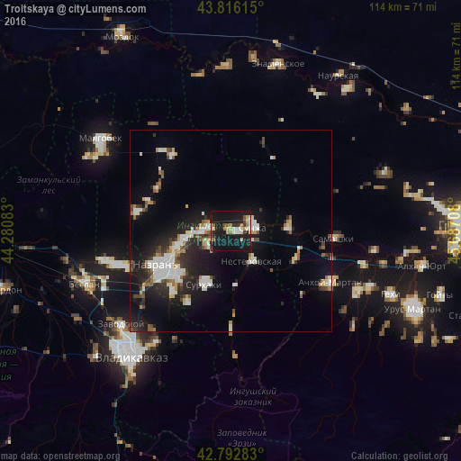
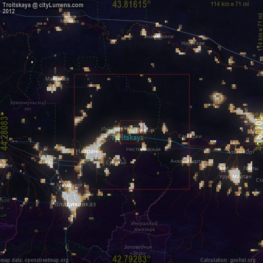
Analysis of Troitskaya night lights 2016
Square area 10x10 km:
 3.18%
3.18%90-99
5.3%80-89
4.24%70-79
3.03%60-69
2.27%50-59
3.33%40-49
2.58%30-39
3.03%20-29
4.55%10-19
58.03%0-9
10.45%Square area 50x50 km:
1.86%90-99
2.66%80-89
0.89%70-79
0.98%60-69
0.96%50-59
1.18%40-49
1.24%30-39
1.46%20-29
3.51%10-19
10.35%0-9
74.91%Clear (daylight) street map image can be seen on geolist.org.
Map coordinates:
43° 48' 58.1" North, 44° 16' 51" East
43° 18' 23.9" North, 44° 59' 2.2" East
42° 47' 34.2" North, 45° 41' 13.5" East
Some cities around Troitskaya sort by population:
• Sunzha
5.5 km =3.4 mi,  74°
74°
• Karabulak
6.8 km =4.2 mi,  268°
268°
• Ekazhevo
16.7 km =10.4 mi,  231°
231°
• Nesterovskaya
9.3 km =5.8 mi,  144°
144°
• Surkhakhi
14.8 km =9.2 mi,  206°
206°
• Assinovskaya
17.6 km =10.9 mi,  114°
114°
• Sernovodsk
14.2 km =8.8 mi,  87°
87°
• Alkhan-Churt
16.7 km =10.4 mi,  287°
287°
481605 (p: 23,745)
Sources (retrieved 2019-11-25):
» Earth at Night: Flat Maps 2012, 2016