Verkhniye Achaluki night lights from space
Night Light of Verkhniye Achaluki (Ingushetiya Republic) from space (Russia) Src. Average luminocity for 10x10km area is 13.0873% and for 50x50km: 13.1898%.
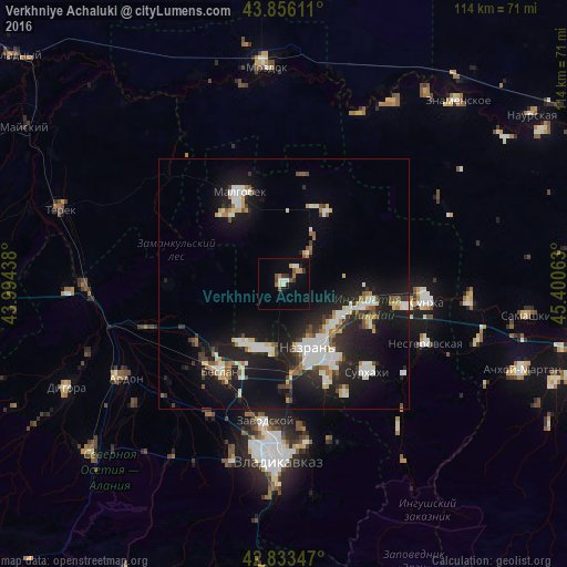
Analysis of Verkhniye Achaluki night lights 2016
Square area 10x10 km:
 0.48%
0.48%90-99
3.81%80-89
0.32%70-79
1.43%60-69
1.9%50-59
1.75%40-49
1.75%30-39
2.22%20-29
0.95%10-19
3.02%0-9
82.38%Square area 50x50 km:
2.15%90-99
2.95%80-89
1.07%70-79
1.01%60-69
1.04%50-59
1.24%40-49
1.27%30-39
1.69%20-29
3.78%10-19
13.66%0-9
70.15%Clear (daylight) street map image can be seen on geolist.org.
Map coordinates:
43° 51' 22" North, 43° 59' 39.8" East
43° 20' 49" North, 44° 41' 51" East
42° 50' 0.5" North, 45° 24' 2.3" East
Some cities around Verkhniye Achaluki sort by population:
• Nazran’
14.8 km =9.2 mi,  155°
155°
• Karabulak
17 km =10.6 mi,  105°
105°
• Kantyshevo
14.2 km =8.8 mi,  201°
201°
• Dalakovo
15 km =9.3 mi,  215°
215°
• Alkhan-Churt
7.3 km =4.5 mi,  85°
85°
• Psedakh
16.9 km =10.5 mi,  322°
322°
• Nizhniye Achaluki
8 km =5 mi,  38°
38°
• Magas
15.1 km =9.4 mi, 156°
475157 (p: 9,393)
Sources (retrieved 2019-11-25):
» Earth at Night: Flat Maps 2012, 2016