Vladimirovac night lights from space
Night Light of Vladimirovac (Vojvodina) from space (Serbia) Src. Average luminocity for 10x10km area is 4.8476% and for 50x50km: 6.6392%.
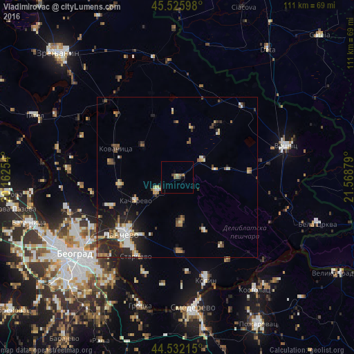
Analysis of Vladimirovac night lights 2016
Square area 10x10 km:
 0%
0%90-99
0%80-89
0.63%70-79
0.63%60-69
1.27%50-59
1.9%40-49
1.27%30-39
0%20-29
0%10-19
1.27%0-9
93.02%Square area 50x50 km:
0.76%90-99
1.18%80-89
0.71%70-79
0.69%60-69
0.82%50-59
0.88%40-49
1.01%30-39
0.86%20-29
2.75%10-19
3.07%0-9
87.28%Clear (daylight) street map image can be seen on geolist.org.
Map coordinates:
45° 31' 33.5" North, 20° 9' 45.1" East
45° 1' 52.4" North, 20° 51' 56.4" East
44° 31' 55.7" North, 21° 34' 7.6" East
Some cities around Vladimirovac sort by population:
• Pančevo
25 km =15.5 mi,  224°
224°
• Vršac
35.7 km =22.2 mi,  74°
74°
• Kovin
32.7 km =20.3 mi,  164°
164°
• Kovačica
21.2 km =13.2 mi,  295°
295°
• Debeljača
21.2 km =13.2 mi,  281°
281°
• Padina
14.6 km =9.1 mi,  312°
312°
• Banatski Karlovac
12.1 km =7.5 mi,  80°
80°
• Crepaja
18.1 km =11.2 mi,  262°
262°
784352 (p: 5,106)
Sources (retrieved 2019-11-25):
» Earth at Night: Flat Maps 2012, 2016