Mokrin night lights from space
Night Light of Mokrin (Vojvodina) from space (Serbia) Src. Average luminocity for 10x10km area is 3.1696% and for 50x50km: 4.1995%.
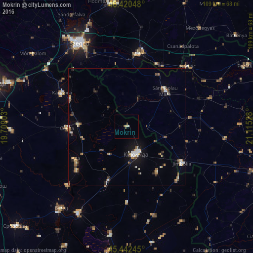
Analysis of Mokrin night lights 2016
Square area 10x10 km:
 0.45%
0.45%90-99
0.15%80-89
1.19%70-79
0%60-69
0%50-59
1.04%40-49
0.74%30-39
0%20-29
0%10-19
0%0-9
96.43%Square area 50x50 km:
0.48%90-99
0.67%80-89
0.41%70-79
0.42%60-69
0.57%50-59
0.52%40-49
0.66%30-39
0.56%20-29
0.6%10-19
1.77%0-9
93.34%Clear (daylight) street map image can be seen on geolist.org.
Map coordinates:
46° 25' 13.7" North, 19° 42' 32.5" East
45° 56' 1" North, 20° 24' 43.7" East
45° 26' 32.8" North, 21° 6' 55" East
Some cities around Mokrin sort by population:
• Kikinda
12.3 km =7.6 mi,  160°
160°
• Senta
25.9 km =16.1 mi,  268°
268°
• Sânnicolau Mare, RO
23.9 km =14.9 mi,  45°
45°
• Lovrin, RO
27.9 km =17.3 mi,  82°
82°
• Novi Kneževac
27.4 km =17 mi,  298°
298°
• Novo Miloševo
25.3 km =15.7 mi,  199°
199°
• Dudeştii Vechi, RO
14.1 km =8.8 mi,  23°
23°
• Čoka
20.8 km =12.9 mi, 272°
787857 (p: 6,567)
Sources (retrieved 2019-11-25):
» Earth at Night: Flat Maps 2012, 2016