Feldioara night lights from space
Night Light of Feldioara (Braşov) from space (Romania) Src. Average luminocity for 10x10km area is 1.2545% and for 50x50km: 7.1774%.
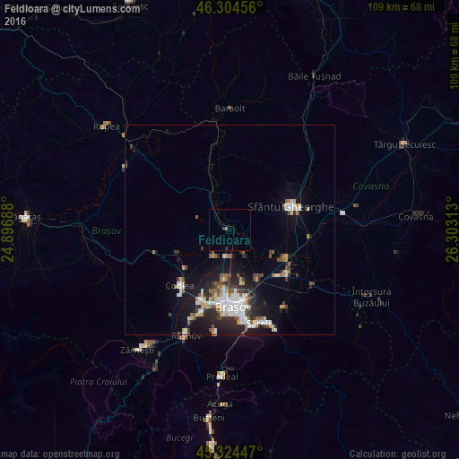
Analysis of Feldioara night lights 2016
Square area 10x10 km:
 0%
0%90-99
0%80-89
0%70-79
0%60-69
0.6%50-59
0%40-49
0.6%30-39
0%20-29
0.6%10-19
0%0-9
98.21%Square area 50x50 km:
1.47%90-99
1.14%80-89
0.65%70-79
0.61%60-69
0.65%50-59
1.01%40-49
0.78%30-39
0.98%20-29
2.18%10-19
5.08%0-9
85.44%Clear (daylight) street map image can be seen on geolist.org.
Map coordinates:
46° 18' 16.4" North, 24° 53' 48.8" East
45° 49' 0" North, 25° 36' 0" East
45° 19' 28.1" North, 26° 18' 11.3" East
Some cities around Feldioara sort by population:
• Braşov
18.7 km =11.6 mi,  178°
178°
• Sfântu Gheorghe
15.3 km =9.5 mi,  68°
68°
• Săcele
23.8 km =14.8 mi,  158°
158°
• Codlea
17.4 km =10.8 mi,  221°
221°
• Prejmer
17.1 km =10.6 mi,  130°
130°
• Tărlungeni
23.5 km =14.6 mi,  150°
150°
• Hălchiu
6.8 km =4.2 mi,  214°
214°
• Vulcan
24.9 km =15.5 mi, 214°
678361 (p: 6,307)
Sources (retrieved 2019-11-25):
» Earth at Night: Flat Maps 2012, 2016