Sector 6 night lights from space
Night Light of Sector 6 (Bucureşti) from space (Romania) Src. Average luminocity for 10x10km area is 89.7286% and for 50x50km: 27.471%.
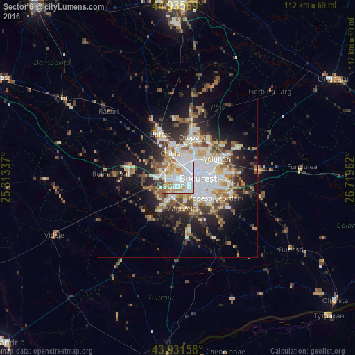
Analysis of Sector 6 night lights 2016
Square area 10x10 km:
 38.57%
90-99
28.1%80-89
10.32%70-79
10.48%60-69
7.46%50-59
3.17%40-49
1.75%30-39
0.16%20-29
0%10-19
0%0-9
0%Square area 50x50 km:
6.61%90-99
5.87%80-89
2.56%70-79
2.95%60-69
3.32%50-59
3.07%40-49
3.86%30-39
3.44%20-29
6.49%10-19
11.56%0-9
50.26%Clear (daylight) street map image can be seen on geolist.org.
Map coordinates:
44° 56' 8.5" North, 25° 18' 48.1" East
44° 26' 8.8" North, 26° 0' 59.4" East
43° 55' 53.7" North, 26° 43' 10.6" East
Some cities around Sector 6 sort by population:
• Bucharest
7.1 km =4.4 mi,  93°
93°
• Chitila
8.5 km =5.3 mi,  341°
341°
• Măgurele
9.6 km =6 mi,  172°
172°
• Bragadiru
7.8 km =4.8 mi,  203°
203°
• Chiajna
4.4 km =2.7 mi,  308°
308°
• Domneşti-Sârbi
9.8 km =6.1 mi,  233°
233°
• Domnești
8.9 km =5.5 mi,  242°
242°
• Mogoşoaia
10.5 km =6.5 mi,  352°
352°
11048323 (p: 367,760)
Sources (retrieved 2019-11-25):
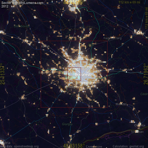
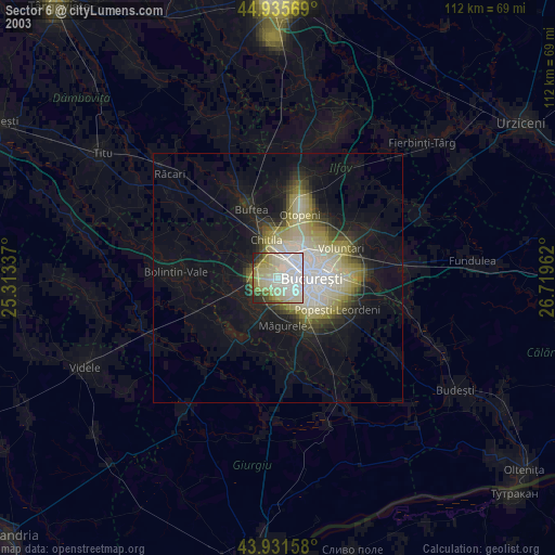
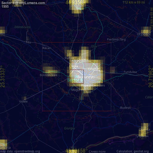
» NASA, Earths city lights 1995
» NASA city lights 2003
» Earth at Night: Flat Maps 2012, 2016