Bucharest night lights from space
Night Light of Bucharest (Bucureşti) from space (Romania) Src. Average luminocity for 10x10km area is 98.9286% and for 50x50km: 27.4998%.
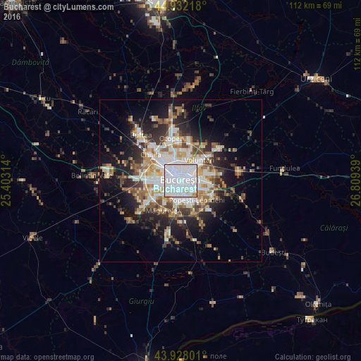
Analysis of Bucharest night lights 2016
Square area 10x10 km:
 73.33%
90-99
23.97%80-89
0.79%70-79
0.79%60-69
1.11%50-59
0%40-49
0%30-39
0%20-29
0%10-19
0%0-9
0%Square area 50x50 km:
6.61%90-99
5.85%80-89
2.59%70-79
3.03%60-69
3.31%50-59
3.12%40-49
3.95%30-39
3.31%20-29
6.41%10-19
11.33%0-9
50.49%Clear (daylight) street map image can be seen on geolist.org.
Map coordinates:
44° 55' 55.8" North, 25° 24' 11.3" East
44° 25' 56.1" North, 26° 6' 22.5" East
43° 55' 40.8" North, 26° 48' 33.8" East
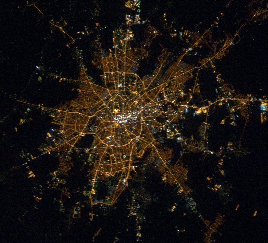
Fantastic image of Bucharest from space taken by astronauts [src2], but I don't have information about it's orientation, scale or angle. If necessary, it was rotated manually, so North points approximately to upper direction. Click to zoom in:
Some cities around Bucharest sort by population:
• Sector 3
5.1 km =3.2 mi,  101°
101°
• Sector 6
7.1 km =4.4 mi,  273°
273°
• Sector 2
3.1 km =1.9 mi,  43°
43°
• Sector 4
6.4 km =4 mi,  169°
169°
• Sector 5
5.6 km =3.5 mi,  209°
209°
• Pantelimon
7.7 km =4.8 mi,  75°
75°
• Popeşti-Leordeni
7.3 km =4.5 mi,  138°
138°
• Dobroeşti
6.4 km =4 mi,  72°
72°
683506 (p: 1,877,155)
Sources (retrieved 2019-11-25):
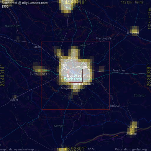
» NASA, Earths city lights 1995
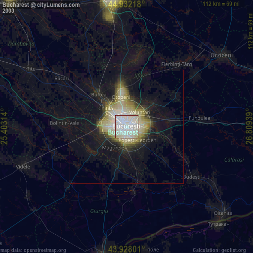
» NASA city lights 2003
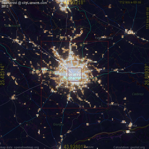
» Earth at Night: Flat Maps 2012, 2016
Src.2: NASA.gov