Salonta night lights from space
Night Light of Salonta (Bihor) from space (Romania) Src. Average luminocity for 10x10km area is 10.8765% and for 50x50km: 1.27%.
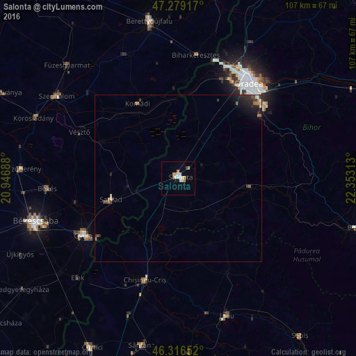
Analysis of Salonta night lights 2016
Square area 10x10 km:
 1.79%
1.79%90-99
2.68%80-89
0.89%70-79
2.98%60-69
0.6%50-59
0%40-49
0.6%30-39
0%20-29
0%10-19
1.93%0-9
88.54%Square area 50x50 km:
0.09%90-99
0.2%80-89
0.09%70-79
0.19%60-69
0.21%50-59
0.09%40-49
0.18%30-39
0.21%20-29
0.45%10-19
0.78%0-9
97.51%Clear (daylight) street map image can be seen on geolist.org.
Map coordinates:
47° 16' 45" North, 20° 56' 48.8" East
46° 48' 0" North, 21° 39' 0" East
46° 18' 59.5" North, 22° 21' 11.3" East
Some cities around Salonta sort by population:
• Oradea
34.1 km =21.2 mi,  36°
36°
• Gyula, HU
32.5 km =20.2 mi,  239°
239°
• Sarkad, HU
21.1 km =13.1 mi,  254°
254°
• Chişineu-Criş
32.2 km =20 mi,  198°
198°
• Vésztő, HU
31.9 km =19.8 mi,  293°
293°
• Cefa
14.4 km =8.9 mi,  26°
26°
• Komádi, HU
25 km =15.5 mi,  332°
332°
• Batăr
16.9 km =10.5 mi,  131°
131°
668129 (p: 17,561)
Sources (retrieved 2019-11-25):
» Earth at Night: Flat Maps 2012, 2016