Praid night lights from space
Night Light of Praid (Harghita) from space (Romania) Src. Average luminocity for 10x10km area is 1.3778% and for 50x50km: 0.2254%.
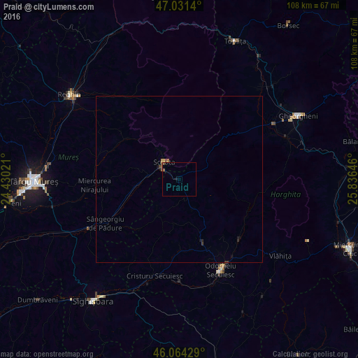
Analysis of Praid night lights 2016
Square area 10x10 km:
 0%
0%90-99
0%80-89
0%70-79
0%60-69
0%50-59
1.14%40-49
0.85%30-39
0%20-29
0%10-19
0.57%0-9
97.44%Square area 50x50 km:
0%90-99
0%80-89
0.02%70-79
0.03%60-69
0.02%50-59
0.08%40-49
0.09%30-39
0.05%20-29
0.04%10-19
0.11%0-9
99.56%Clear (daylight) street map image can be seen on geolist.org.
Map coordinates:
47° 1' 53" North, 24° 25' 48.8" East
46° 33' 0" North, 25° 7' 60" East
46° 3' 51.4" North, 25° 50' 11.3" East
Some cities around Praid sort by population:
• Odorheiu Secuiesc
30.6 km =19 mi,  155°
155°
• Sovata
6.3 km =3.9 mi,  306°
306°
• Cristuru Secuiesc
30.6 km =19 mi,  194°
194°
• Gurghiu
32.4 km =20.1 mi,  318°
318°
• Corund
10 km =6.2 mi, 157°
• Miercurea Nirajului
25.6 km =15.9 mi,  265°
265°
• Zetea
25.7 km =16 mi,  136°
136°
• Joseni
32.6 km =20.3 mi,  59°
59°
669735 (p: 6,739)
Sources (retrieved 2019-11-25):
» Earth at Night: Flat Maps 2012, 2016