Plopşoru night lights from space
Night Light of Plopşoru (Gorj) from space (Romania) Src. Average luminocity for 10x10km area is 0.2985% and for 50x50km: 1.0129%.
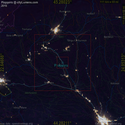
Analysis of Plopşoru night lights 2016
Square area 10x10 km:
 0%
0%90-99
0%80-89
0%70-79
0%60-69
0%50-59
0%40-49
0%30-39
0%20-29
0.61%10-19
0.61%0-9
98.79%Square area 50x50 km:
0.01%90-99
0.02%80-89
0.2%70-79
0.09%60-69
0.11%50-59
0.23%40-49
0.29%30-39
0.21%20-29
0.38%10-19
0.47%0-9
97.98%Clear (daylight) street map image can be seen on geolist.org.
Map coordinates:
45° 16' 48.8" North, 22° 38' 48.8" East
44° 46' 60" North, 23° 21' 0" East
44° 16' 55.6" North, 24° 3' 11.3" East
Some cities around Plopşoru sort by population:
• Rovinari
19.8 km =12.3 mi,  318°
318°
• Strehaia
22 km =13.7 mi,  212°
212°
• Târgu Cărbuneşti
22.7 km =14.1 mi,  35°
35°
• Turceni
11.2 km =7 mi,  173°
173°
• Corcova
25.4 km =15.8 mi,  248°
248°
• Mătăsari
22.3 km =13.9 mi,  289°
289°
• Ţicleni
11.8 km =7.3 mi,  19°
19°
• Drăguţeşti
22.4 km =13.9 mi,  335°
335°
670432 (p: 6,576)
Sources (retrieved 2019-11-25):
» Earth at Night: Flat Maps 2012, 2016