Târgu Cărbuneşti night lights from space
Night Light of Târgu Cărbuneşti (Gorj) from space (Romania) Src. Average luminocity for 10x10km area is 0.5429% and for 50x50km: 1.4829%.
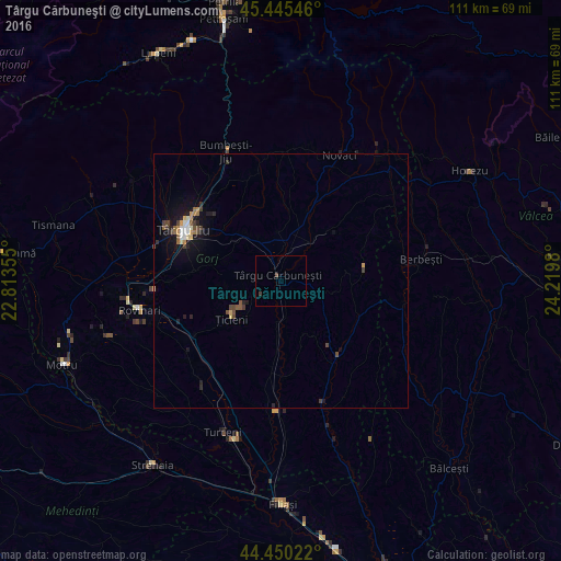
Analysis of Târgu Cărbuneşti night lights 2016
Square area 10x10 km:
 0%
0%90-99
0%80-89
0%70-79
0%60-69
0%50-59
0%40-49
0.63%30-39
0.63%20-29
0%10-19
0%0-9
98.73%Square area 50x50 km:
0.12%90-99
0.16%80-89
0.15%70-79
0.17%60-69
0.14%50-59
0.28%40-49
0.33%30-39
0.25%20-29
0.28%10-19
1.32%0-9
96.8%Clear (daylight) street map image can be seen on geolist.org.
Map coordinates:
45° 26' 43.7" North, 22° 48' 48.8" East
44° 57' 0" North, 23° 31' 0" East
44° 27' 0.8" North, 24° 13' 11.3" East
Some cities around Târgu Cărbuneşti sort by population:
• Rovinari
26.5 km =16.5 mi,  261°
261°
• Bumbeşti-Jiu
25.8 km =16 mi,  339°
339°
• Băleşti
24.7 km =15.3 mi,  287°
287°
• Plopşoru
22.7 km =14.1 mi,  215°
215°
• Berbeşti
29.1 km =18.1 mi,  82°
82°
• Crasna
24.1 km =15 mi,  356°
356°
• Ţicleni
11.8 km =7.3 mi,  231°
231°
• Drăguţeşti
22.4 km =13.9 mi,  274°
274°
665017 (p: 8,646)
Sources (retrieved 2019-11-25):
» Earth at Night: Flat Maps 2012, 2016