Mătăsari night lights from space
Night Light of Mătăsari (Gorj) from space (Romania) Src. Average luminocity for 10x10km area is 1.8159% and for 50x50km: 1.8404%.
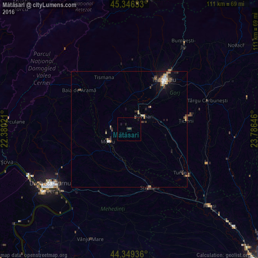
Analysis of Mătăsari night lights 2016
Square area 10x10 km:
 0%
0%90-99
0%80-89
0%70-79
0%60-69
0%50-59
1.43%40-49
0.16%30-39
0.63%20-29
0.95%10-19
0.95%0-9
95.87%Square area 50x50 km:
0.17%90-99
0.2%80-89
0.35%70-79
0.18%60-69
0.19%50-59
0.24%40-49
0.41%30-39
0.3%20-29
0.42%10-19
1.16%0-9
96.38%Clear (daylight) street map image can be seen on geolist.org.
Map coordinates:
45° 20' 46.8" North, 22° 22' 48.8" East
44° 51' 0" North, 23° 4' 60" East
44° 20' 57.7" North, 23° 47' 11.3" East
Some cities around Mătăsari sort by population:
• Motru
10.2 km =6.3 mi,  239°
239°
• Rovinari
10.8 km =6.7 mi,  46°
46°
• Tismana
24.1 km =15 mi,  337°
337°
• Băleşti
21.3 km =13.2 mi,  29°
29°
• Plopşoru
22.3 km =13.9 mi,  109°
109°
• Corcova
16.9 km =10.5 mi,  188°
188°
• Ţicleni
25.2 km =15.7 mi,  81°
81°
• Drăguţeşti
17.5 km =10.9 mi,  42°
42°
673695 (p: 5,411)
Sources (retrieved 2019-11-25):
» Earth at Night: Flat Maps 2012, 2016