Lehliu-Gară night lights from space
Night Light of Lehliu-Gară (Călăraşi) from space (Romania) Src. Average luminocity for 10x10km area is 5.1778% and for 50x50km: 0.5217%.
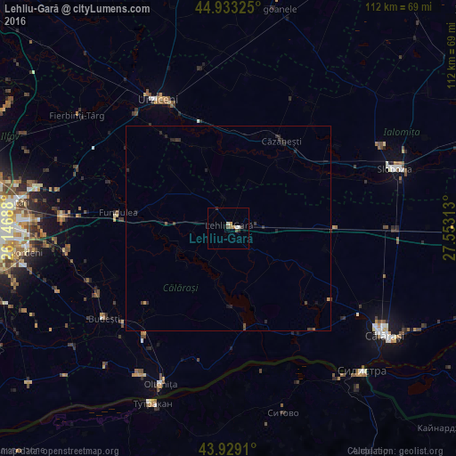
Analysis of Lehliu-Gară night lights 2016
Square area 10x10 km:
 0.63%
0.63%90-99
1.27%80-89
0.16%70-79
0.48%60-69
1.27%50-59
0.63%40-49
0.63%30-39
0.95%20-29
0.63%10-19
0.63%0-9
92.7%Square area 50x50 km:
0.02%90-99
0.05%80-89
0.01%70-79
0.06%60-69
0.07%50-59
0.03%40-49
0.12%30-39
0.2%20-29
0.43%10-19
0.15%0-9
98.86%Clear (daylight) street map image can be seen on geolist.org.
Map coordinates:
44° 55' 59.7" North, 26° 8' 48.8" East
44° 25' 60" North, 26° 51' 0" East
43° 55' 44.8" North, 27° 33' 11.3" East
Some cities around Lehliu-Gară sort by population:
• Urziceni
35.9 km =22.3 mi,  331°
331°
• Vasilaţi
35.9 km =22.3 mi,  243°
243°
• Coşereni
35.7 km =22.2 mi,  321°
321°
• Dor Mărunt
5.6 km =3.5 mi,  70°
70°
• Fundulea
26.7 km =16.6 mi,  277°
277°
• Mânăstirea
24.4 km =15.2 mi,  170°
170°
• Ulmeni
33.2 km =20.6 mi,  198°
198°
• Curcani
33.5 km =20.8 mi,  219°
219°
674916 (p: 6,538)
Sources (retrieved 2019-11-25):
» Earth at Night: Flat Maps 2012, 2016