Dor Mărunt night lights from space
Night Light of Dor Mărunt (Călăraşi) from space (Romania) Src. Average luminocity for 10x10km area is 4.4063% and for 50x50km: 0.5343%.
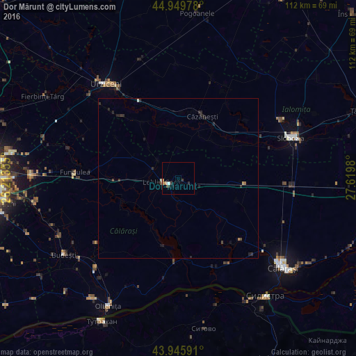
Analysis of Dor Mărunt night lights 2016
Square area 10x10 km:
 0.63%
0.63%90-99
0.63%80-89
0.16%70-79
0.48%60-69
1.27%50-59
0.32%40-49
0.32%30-39
1.27%20-29
1.27%10-19
0.63%0-9
93.02%Square area 50x50 km:
0.02%90-99
0.07%80-89
0.01%70-79
0.06%60-69
0.09%50-59
0.02%40-49
0.1%30-39
0.18%20-29
0.45%10-19
0.13%0-9
98.87%Clear (daylight) street map image can be seen on geolist.org.
Map coordinates:
44° 56' 59.2" North, 26° 12' 48.8" East
44° 27' 0" North, 26° 55' 0" East
43° 56' 45.3" North, 27° 37' 11.3" East
Some cities around Dor Mărunt sort by population:
• Urziceni
37.2 km =23.1 mi,  322°
322°
• Dragalina
31.8 km =19.8 mi,  93°
93°
• Amara
36.7 km =22.8 mi,  59°
59°
• Fundulea
31.8 km =19.8 mi,  273°
273°
• Lehliu-Gară
5.6 km =3.5 mi,  250°
250°
• Mânăstirea
26 km =16.2 mi,  182°
182°
• Ulmeni
37 km =23 mi,  205°
205°
• Grădiştea
33.9 km =21.1 mi,  135°
135°
679095 (p: 6,806)
Sources (retrieved 2019-11-25):
» Earth at Night: Flat Maps 2012, 2016