Fundeni night lights from space
Night Light of Fundeni (Călăraşi) from space (Romania) Src. Average luminocity for 10x10km area is 8.0333% and for 50x50km: 18.2785%.
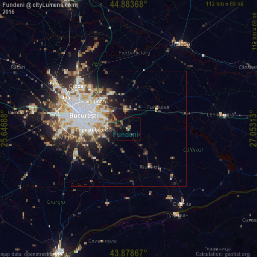
Analysis of Fundeni night lights 2016
Square area 10x10 km:
 0%
0%90-99
0%80-89
0.63%70-79
0%60-69
2.86%50-59
1.43%40-49
2.06%30-39
1.43%20-29
2.38%10-19
7.46%0-9
81.75%Square area 50x50 km:
5.32%90-99
4%80-89
1.65%70-79
1.86%60-69
2.04%50-59
1.75%40-49
2.49%30-39
2%20-29
3.72%10-19
5.16%0-9
70%Clear (daylight) street map image can be seen on geolist.org.
Map coordinates:
44° 53' 1.2" North, 25° 38' 48.8" East
44° 22' 60" North, 26° 21' 0" East
43° 52' 43.2" North, 27° 3' 11.3" East
Some cities around Fundeni sort by population:
• Sector 3
15.1 km =9.4 mi,  287°
287°
• Pantelimon
14 km =8.7 mi,  301°
301°
• Popeşti-Leordeni
14.6 km =9.1 mi,  270°
270°
• Cernica
6.5 km =4 mi, 304°
• Brăneşti
7.5 km =4.7 mi,  349°
349°
• Vasilaţi
13.2 km =8.2 mi,  143°
143°
• Glina
7.9 km =4.9 mi, 270°
• Frumuşani
9.9 km =6.2 mi,  191°
191°
677812 (p: 5,443)
Sources (retrieved 2019-11-25):
» Earth at Night: Flat Maps 2012, 2016