Fărcaşele night lights from space
Night Light of Fărcaşele (Olt) from space (Romania) Src. Average luminocity for 10x10km area is 1.4545% and for 50x50km: 0.8014%.
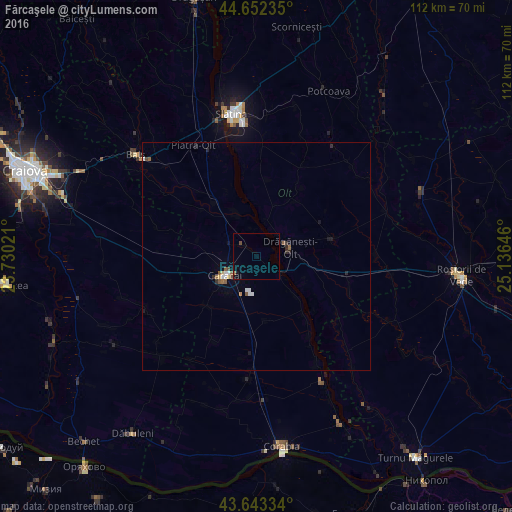
Analysis of Fărcaşele night lights 2016
Square area 10x10 km:
 0%
0%90-99
0%80-89
0%70-79
0%60-69
0.61%50-59
0%40-49
0.61%30-39
0%20-29
0%10-19
0.61%0-9
98.18%Square area 50x50 km:
0.09%90-99
0.13%80-89
0.07%70-79
0.01%60-69
0.12%50-59
0.19%40-49
0.1%30-39
0.06%20-29
0.16%10-19
0.23%0-9
98.83%Clear (daylight) street map image can be seen on geolist.org.
Map coordinates:
44° 39' 8.5" North, 23° 43' 48.8" East
44° 9' 0" North, 24° 25' 60" East
43° 38' 36" North, 25° 8' 11.3" East
Some cities around Fărcaşele sort by population:
• Slatina
31.9 km =19.8 mi,  350°
350°
• Caracal
7.6 km =4.7 mi,  240°
240°
• Balş
34.6 km =21.5 mi,  309°
309°
• Drăgăneşti-Olt
8.2 km =5.1 mi,  76°
76°
• Piatra Olt
27.5 km =17.1 mi,  331°
331°
• Amărăştii de Jos
30.8 km =19.1 mi,  223°
223°
• Osica de Sus
14.5 km =9 mi,  320°
320°
• Celaru
26.4 km =16.4 mi,  245°
245°
678430 (p: 5,045)
Sources (retrieved 2019-11-25):
» Earth at Night: Flat Maps 2012, 2016