Celaru night lights from space
Night Light of Celaru (Dolj) from space (Romania) Src. Average luminocity for 10x10km area is 0.1% and for 50x50km: 1.053%.
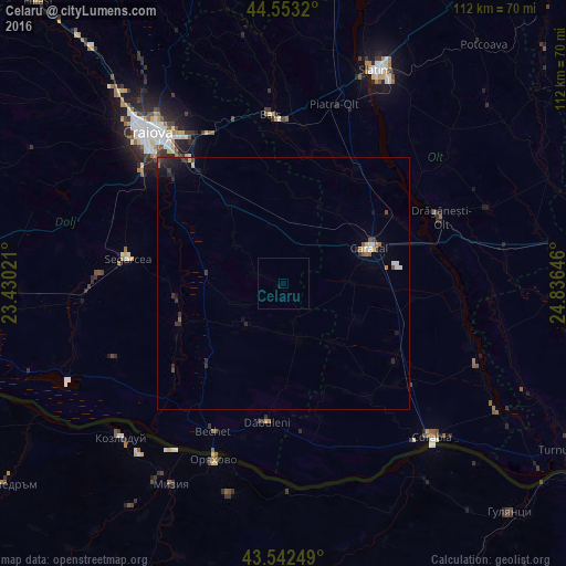
Analysis of Celaru night lights 2016
Square area 10x10 km:
 0%
0%90-99
0%80-89
0%70-79
0%60-69
0%50-59
0%40-49
0%30-39
0%20-29
0%10-19
0.63%0-9
99.37%Square area 50x50 km:
0.09%90-99
0.1%80-89
0.12%70-79
0.04%60-69
0.13%50-59
0.17%40-49
0.18%30-39
0.25%20-29
0.37%10-19
0.62%0-9
97.93%Clear (daylight) street map image can be seen on geolist.org.
Map coordinates:
44° 33' 11.5" North, 23° 25' 48.8" East
44° 3' 0" North, 24° 7' 60" East
43° 32' 33" North, 24° 50' 11.3" East
Some cities around Celaru sort by population:
• Caracal
18.8 km =11.7 mi,  66°
66°
• Sadova
22.2 km =13.8 mi,  221°
221°
• Dăneţi
10 km =6.2 mi, 221°
• Valea Stanciului
22.6 km =14 mi,  250°
250°
• Amărăştii de Jos
11.4 km =7.1 mi,  166°
166°
• Leu
18.2 km =11.3 mi,  324°
324°
• Osica de Sus
26.6 km =16.5 mi,  33°
33°
• Fărcaşele
26.4 km =16.4 mi, 65°
682436 (p: 5,326)
Sources (retrieved 2019-11-25):
» Earth at Night: Flat Maps 2012, 2016