Petite-Île night lights from space
Night Light of Petite-Île (Réunion) from space (Reunion) Src. Average luminocity for 10x10km area is 11.8523% and for 50x50km: 6.2997%.
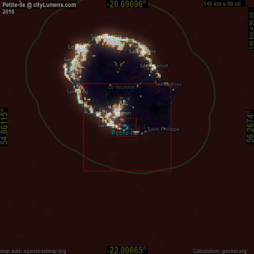
Analysis of Petite-Île night lights 2016
Square area 10x10 km:
 0%
0%90-99
0.76%80-89
0.38%70-79
0.76%60-69
2.27%50-59
1.52%40-49
3.22%30-39
3.6%20-29
7.39%10-19
10.61%0-9
69.51%Square area 50x50 km:
0.67%90-99
0.93%80-89
0.61%70-79
0.49%60-69
0.92%50-59
0.69%40-49
1.29%30-39
1.44%20-29
1.91%10-19
6.03%0-9
85.01%Clear (daylight) street map image can be seen on geolist.org.
Map coordinates:
20° 41' 49.1" South, 54° 51' 40.1" East
21° 21' 11.8" South, 55° 33' 51.4" East
22° 0' 23.9" South, 56° 16' 2.6" East
Some cities around Petite-Île sort by population:
• Saint-Pierre
9.1 km =5.7 mi,  279°
279°
• Le Tampon
9.8 km =6.1 mi,  330°
330°
• Saint-Louis
17.5 km =10.9 mi,  295°
295°
• Saint-Joseph
6.1 km =3.8 mi,  116°
116°
• Les Avirons
26.7 km =16.6 mi, 297°
• Cilaos
25.9 km =16.1 mi,  338°
338°
• Entre-Deux
16.7 km =10.4 mi,  322°
322°
• Saint-Philippe
21.1 km =13.1 mi,  92°
92°
935416 (p: 10,961)
Sources (retrieved 2019-11-25):
» Earth at Night: Flat Maps 2012, 2016