Madīnat ash Shamāl night lights from space
Night Light of Madīnat ash Shamāl from space (Qatar) Src. Average luminocity for 10x10km area is 33.2321% and for 50x50km: 7.4093%.
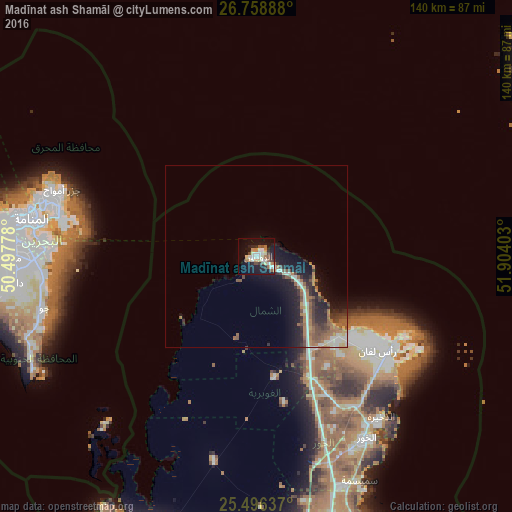
Analysis of Madīnat ash Shamāl night lights 2016
Square area 10x10 km:
 5.36%
5.36%90-99
7.14%80-89
3.77%70-79
2.18%60-69
5.95%50-59
3.77%40-49
3.97%30-39
1.98%20-29
7.14%10-19
33.33%0-9
25.4%Square area 50x50 km:
0.82%90-99
1.15%80-89
0.47%70-79
0.42%60-69
1.83%50-59
1.6%40-49
1.16%30-39
1.11%20-29
2.24%10-19
6.14%0-9
83.06%Clear (daylight) street map image can be seen on geolist.org.
Map coordinates:
26° 45' 32" North, 50° 29' 52" East
26° 7' 45.6" North, 51° 12' 3.2" East
25° 29' 46.9" North, 51° 54' 14.5" East
Some cities around Madīnat ash Shamāl sort by population:
• Manama, BH
62.4 km =38.8 mi,  280°
280°
• Al Muharraq, BH
60.5 km =37.6 mi, 283°
• Ar Rifā‘, BH
64.5 km =40.1 mi,  270°
270°
• Sitrah, BH
58 km =36 mi, 272°
• Jidd Ḩafş, BH
65.9 km =40.9 mi, 278°
• Al Khawr
58.2 km =36.2 mi,  148°
148°
• Al Ḩadd, BH
56.1 km =34.9 mi, 283°
• Az̧ Z̧a‘āyin
67.5 km =41.9 mi,  155°
155°
289739 (p: 5,267)
Sources (retrieved 2019-11-25):
» Earth at Night: Flat Maps 2012, 2016