Al Khawr night lights from space
Night Light of Al Khawr (Al Khor) from space (Qatar) Src. Average luminocity for 10x10km area is 72.8144% and for 50x50km: 33.573%.
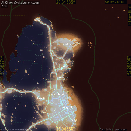
Analysis of Al Khawr night lights 2016
Square area 10x10 km:
 15.72%
90-99
15.91%80-89
10.04%70-79
13.64%60-69
16.48%50-59
8.14%40-49
10.8%30-39
7.01%20-29
2.27%10-19
0%0-9
0%Square area 50x50 km:
3.78%90-99
5.39%80-89
3.23%70-79
4.74%60-69
10.9%50-59
7.29%40-49
5.3%30-39
4.93%20-29
6.34%10-19
8.09%0-9
40%Clear (daylight) street map image can be seen on geolist.org.
Map coordinates:
26° 18' 57.1" North, 50° 48' 9.8" East
25° 41' 2" North, 51° 30' 21" East
25° 2' 54.8" North, 52° 12' 32.3" East
Some cities around Al Khawr sort by population:
• Doha
44.4 km =27.6 mi,  176°
176°
• Ar Rayyān
44.3 km =27.5 mi,  190°
190°
• Umm Şalāl Muḩammad
31.5 km =19.6 mi,  198°
198°
• Al Wakrah
57.8 km =35.9 mi,  170°
170°
• Ash Shīḩānīyah
44.9 km =27.9 mi,  219°
219°
• Madīnat ash Shamāl
58.2 km =36.2 mi,  328°
328°
• Umm Şalāl ‘Alī
26.2 km =16.3 mi, 204°
• Az̧ Z̧a‘āyin
12.1 km =7.5 mi, 190°
289962 (p: 18,923)
Sources (retrieved 2019-11-25):
» Earth at Night: Flat Maps 2012, 2016