Salto del Guairá night lights from space
Night Light of Salto del Guairá (Canindeyú) from space (Paraguay) Src. Average luminocity for 10x10km area is 32.1004% and for 50x50km: 3.6955%.
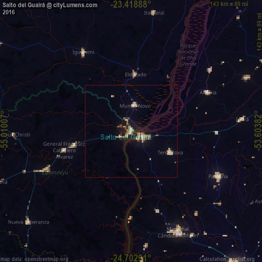
Analysis of Salto del Guairá night lights 2016
Square area 10x10 km:
 2.27%
2.27%90-99
3.03%80-89
5.11%70-79
6.06%60-69
8.52%50-59
2.65%40-49
3.03%30-39
3.03%20-29
5.87%10-19
48.3%0-9
12.12%Square area 50x50 km:
0.24%90-99
0.33%80-89
0.54%70-79
0.71%60-69
0.81%50-59
0.33%40-49
0.46%30-39
0.33%20-29
0.51%10-19
3.2%0-9
92.55%Clear (daylight) street map image can be seen on geolist.org.
Map coordinates:
23° 25' 8" South, 55° 0' 36.3" West
24° 3' 45" South, 54° 18' 25" West
24° 42' 10.5" South, 53° 36' 13.8" West
Some cities around Salto del Guairá sort by population:
• Marechal Cândido Rondon, BR
60.5 km =37.6 mi,  155°
155°
• Palotina, BR
53.4 km =33.2 mi,  117°
117°
• Costa Rica, BR
79.8 km =49.6 mi,  334°
334°
• Nueva Esperanza
74.4 km =46.2 mi,  228°
228°
• Altãnia, BR
46.2 km =28.7 mi,  63°
63°
• Iporã, BR
61.6 km =38.3 mi,  83°
83°
• Iguatemi, BR
49.7 km =30.9 mi, 328°
• Eldorado, BR
30.7 km =19.1 mi,  4°
4°
3437148 (p: 7,385)
Sources (retrieved 2019-11-25):
» Earth at Night: Flat Maps 2012, 2016