Sobreda night lights from space
Night Light of Sobreda (District of Setúbal) from space (Portugal) Src. Average luminocity for 10x10km area is 83.9351% and for 50x50km: 46.2497%.
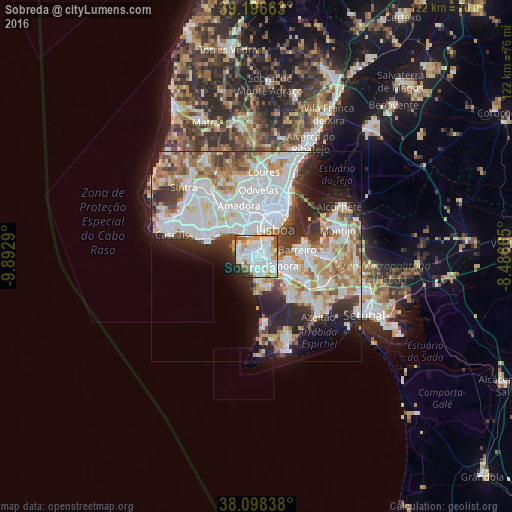
Analysis of Sobreda night lights 2016
Square area 10x10 km:
 34.9%
34.9%90-99
27.6%80-89
5.03%70-79
9.25%60-69
7.79%50-59
5.84%40-49
1.14%30-39
2.76%20-29
4.55%10-19
1.14%0-9
0%Square area 50x50 km:
15.02%90-99
11.99%80-89
4.24%70-79
4.87%60-69
5.71%50-59
3.99%40-49
3.62%30-39
4.56%20-29
7.76%10-19
7.9%0-9
30.34%Clear (daylight) street map image can be seen on geolist.org.
Map coordinates:
39° 11' 47.9" North, 9° 53' 34.4" West
38° 38' 58.6" North, 9° 11' 23.2" West
38° 5' 54.2" North, 8° 29' 11.9" West
Some cities around Sobreda sort by population:
• Corroios
3.5 km =2.2 mi,  107°
107°
• Almada
4.3 km =2.7 mi,  41°
41°
• Charneca de Caparica
3.3 km =2.1 mi,  186°
186°
• Caparica
1.6 km =1 mi,  325°
325°
• Laranjeira
3.2 km =2 mi,  77°
77°
• Piedade
3.5 km =2.2 mi,  50°
50°
• Costa de Caparica
4 km =2.5 mi,  261°
261°
• Pragal
3.3 km =2.1 mi,  31°
31°
2262865 (p: 11,146)
Sources (retrieved 2019-11-25):
» Earth at Night: Flat Maps 2012, 2016