Serzedo night lights from space
Night Light of Serzedo (Porto) from space (Portugal) Src. Average luminocity for 10x10km area is 86.8112% and for 50x50km: 42.3068%.
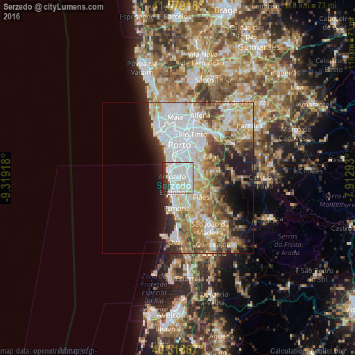
Analysis of Serzedo night lights 2016
Square area 10x10 km:
 43.54%
90-99
32.48%80-89
6.46%70-79
0%60-69
0.68%50-59
1.36%40-49
0.51%30-39
8.84%20-29
6.12%10-19
0%0-9
0%Square area 50x50 km:
13.23%90-99
9.23%80-89
4.66%70-79
5.81%60-69
6.28%50-59
4.13%40-49
3.54%30-39
4.05%20-29
5.47%10-19
6.8%0-9
36.81%Clear (daylight) street map image can be seen on geolist.org.
Map coordinates:
41° 34' 45" North, 9° 19' 9" West
41° 3' 3.8" North, 8° 36' 57.8" West
40° 31' 7.2" North, 7° 54' 46.5" West
Some cities around Serzedo sort by population:
• Arcozelo
1.8 km =1.1 mi,  312°
312°
• Canelas
3.8 km =2.4 mi,  20°
20°
• Azenha
2.9 km =1.8 mi,  345°
345°
• São Félix da Marinha
1.8 km =1.1 mi,  197°
197°
• Grijó
3.9 km =2.4 mi,  129°
129°
• Gulpilhares
3.7 km =2.3 mi, 345°
• Perozinho
3 km =1.9 mi,  58°
58°
• Vila Nova da Telha
3.1 km =1.9 mi,  317°
317°
2734029 (p: 7,891)
Sources (retrieved 2019-11-25):
» Earth at Night: Flat Maps 2012, 2016