Lousã night lights from space
Night Light of Lousã (Coimbra) from space (Portugal) Src. Average luminocity for 10x10km area is 17.7646% and for 50x50km: 13.4662%.
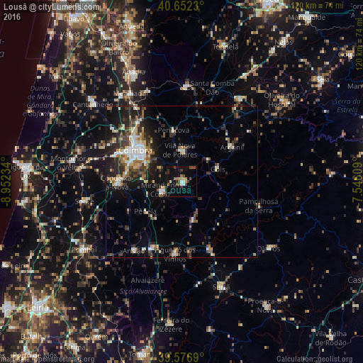
Analysis of Lousã night lights 2016
Square area 10x10 km:
 1.62%
1.62%90-99
1.14%80-89
0.65%70-79
2.44%60-69
3.57%50-59
3.41%40-49
2.76%30-39
3.25%20-29
2.92%10-19
15.91%0-9
62.34%Square area 50x50 km:
1.66%90-99
2.08%80-89
1.1%70-79
1.32%60-69
1.68%50-59
2.05%40-49
1.93%30-39
3.09%20-29
4.69%10-19
7.36%0-9
73.04%Clear (daylight) street map image can be seen on geolist.org.
Map coordinates:
40° 39' 8.3" North, 8° 57' 8.4" West
40° 7' 0.2" North, 8° 14' 57.2" West
39° 34' 36.8" North, 7° 32' 45.9" West
Some cities around Lousã sort by population:
• Coimbra
17.5 km =10.9 mi,  304°
304°
• Santo António dos Olivais
17.4 km =10.8 mi,  310°
310°
• Condeixa-a-Nova
21.2 km =13.2 mi,  268°
268°
• Santa Clara
18.7 km =11.6 mi, 299°
• Soure
32.7 km =20.3 mi,  258°
258°
• Miranda do Corvo
7.6 km =4.7 mi,  249°
249°
• Poiares
10.4 km =6.5 mi,  356°
356°
• Assafarge
16.2 km =10.1 mi,  286°
286°
2738154 (p: 11,445)
Sources (retrieved 2019-11-25):
» Earth at Night: Flat Maps 2012, 2016