Colares night lights from space
Night Light of Colares (Lisbon) from space (Portugal) Src. Average luminocity for 10x10km area is 50.449% and for 50x50km: 31.3663%.
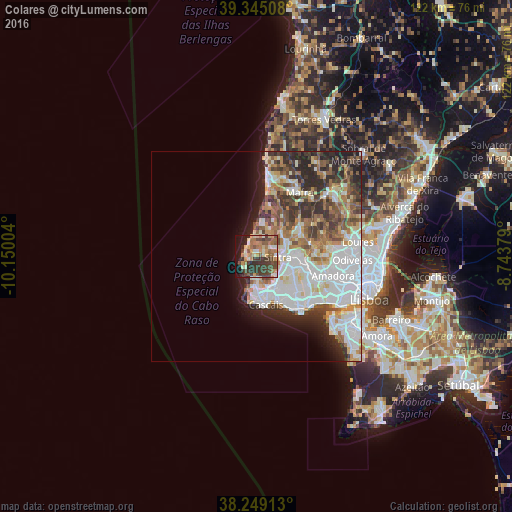
Analysis of Colares night lights 2016
Square area 10x10 km:
 2.21%
2.21%90-99
9.01%80-89
5.44%70-79
9.35%60-69
12.93%50-59
7.99%40-49
14.46%30-39
16.33%20-29
6.29%10-19
15.14%0-9
0.85%Square area 50x50 km:
9.37%90-99
7.16%80-89
3%70-79
2.72%60-69
4.19%50-59
3.75%40-49
3.78%30-39
4.77%20-29
5.94%10-19
5.14%0-9
50.19%Clear (daylight) street map image can be seen on geolist.org.
Map coordinates:
39° 20' 42.3" North, 10° 9' 0.1" West
38° 47' 57.2" North, 9° 26' 48.9" West
38° 14' 56.9" North, 8° 44' 37.6" West
Some cities around Colares sort by population:
• Algueirão
8.9 km =5.5 mi,  91°
91°
• Rio de Mouro
10.9 km =6.8 mi,  109°
109°
• Alcabideche
8 km =5 mi,  155°
155°
• Sintra
6 km =3.7 mi, 88°
• Monte Estoril
10.9 km =6.8 mi, 161°
• São João das Lampas
9.3 km =5.8 mi,  26°
26°
• Mem Martins
9 km =5.6 mi, 93°
• Fontanelas
5.5 km =3.4 mi,  6°
6°
2269142 (p: 7,905)
Sources (retrieved 2019-11-25):
» Earth at Night: Flat Maps 2012, 2016