Alcabideche night lights from space
Night Light of Alcabideche (Lisbon) from space (Portugal) Src. Average luminocity for 10x10km area is 81.7619% and for 50x50km: 33.1233%.
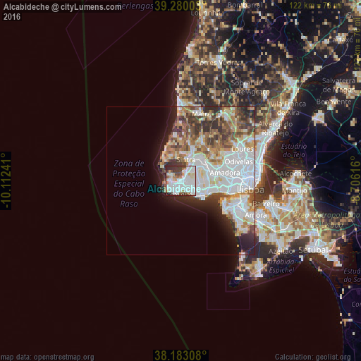
Analysis of Alcabideche night lights 2016
Square area 10x10 km:
 31.29%
90-99
31.46%80-89
5.27%70-79
3.91%60-69
5.44%50-59
4.42%40-49
7.14%30-39
7.31%20-29
3.74%10-19
0%0-9
0%Square area 50x50 km:
11.17%90-99
7.77%80-89
2.92%70-79
3.07%60-69
4.12%50-59
3.5%40-49
3.68%30-39
3.99%20-29
4.55%10-19
5.15%0-9
50.07%Clear (daylight) street map image can be seen on geolist.org.
Map coordinates:
39° 16' 48.1" North, 10° 6' 44.7" West
38° 44' 1.2" North, 9° 24' 33.4" West
38° 10' 59.1" North, 8° 42' 22.2" West
Some cities around Alcabideche sort by population:
• Rio de Mouro
7.9 km =4.9 mi,  62°
62°
• São Domingos de Rana
6.9 km =4.3 mi,  120°
120°
• Cascais
4.2 km =2.6 mi,  194°
194°
• Sintra
8 km =5 mi,  19°
19°
• Estoril
3.3 km =2.1 mi,  162°
162°
• Monte Estoril
3 km =1.9 mi,  174°
174°
• Parede
6.6 km =4.1 mi,  133°
133°
• Colares
8 km =5 mi,  335°
335°
2272215 (p: 33,315)
Sources (retrieved 2019-11-25):
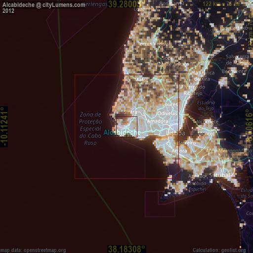
» Earth at Night: Flat Maps 2012, 2016