Monte Estoril night lights from space
Night Light of Monte Estoril (Lisbon) from space (Portugal) Src. Average luminocity for 10x10km area is 71.6412% and for 50x50km: 32.0812%.
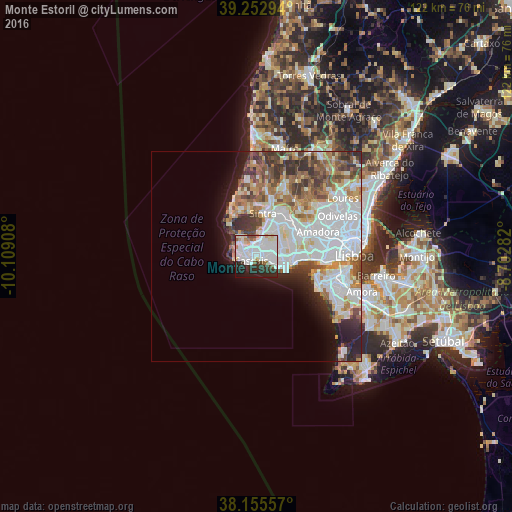
Analysis of Monte Estoril night lights 2016
Square area 10x10 km:
 28.23%
90-99
26.7%80-89
3.91%70-79
1.87%60-69
4.25%50-59
3.4%40-49
1.87%30-39
6.8%20-29
15.82%10-19
7.14%0-9
0%Square area 50x50 km:
11.19%90-99
7.54%80-89
2.63%70-79
2.91%60-69
3.84%50-59
3.3%40-49
3.64%30-39
3.83%20-29
4.14%10-19
5.13%0-9
51.86%Clear (daylight) street map image can be seen on geolist.org.
Map coordinates:
39° 15' 10.6" North, 10° 6' 32.7" West
38° 42' 22.9" North, 9° 24' 21.4" West
38° 9' 20.1" North, 8° 42' 10.2" West
Some cities around Monte Estoril sort by population:
• São Domingos de Rana
5.7 km =3.5 mi,  94°
94°
• Cascais
1.7 km =1.1 mi,  231°
231°
• Oeiras
8.4 km =5.2 mi,  101°
101°
• Alcabideche
3 km =1.9 mi,  354°
354°
• Estoril
0.7 km =0.4 mi, 95°
• Carcavelos
7.5 km =4.7 mi, 103°
• Parede
4.7 km =2.9 mi,  108°
108°
• Porto Salvo
9 km =5.6 mi,  78°
78°
2265927 (p: 23,375)
Sources (retrieved 2019-11-25):
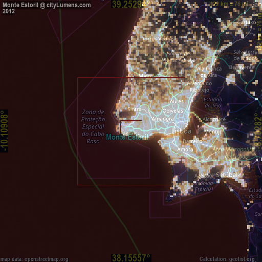
» Earth at Night: Flat Maps 2012, 2016