Nablus night lights from space
Night Light of Nablus (West Bank) from space (Palestinian Territory) Src. Average luminocity for 10x10km area is 70.0262% and for 50x50km: 42.3827%.
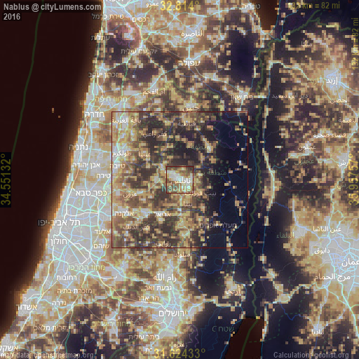
Analysis of Nablus night lights 2016
Square area 10x10 km:
 13.64%
90-99
14.34%80-89
11.89%70-79
12.59%60-69
8.39%50-59
15.38%40-49
15.21%30-39
5.77%20-29
2.8%10-19
0%0-9
0%Square area 50x50 km:
3.05%90-99
4.27%80-89
8.1%70-79
9.41%60-69
6.24%50-59
7.64%40-49
10.97%30-39
9.92%20-29
11.88%10-19
8.43%0-9
20.09%Clear (daylight) street map image can be seen on geolist.org.
Map coordinates:
32° 48' 50.4" North, 34° 33' 4.8" East
32° 13' 16" North, 35° 15' 16" East
31° 37' 27.6" North, 35° 57' 27.3" East
Some cities around Nablus sort by population:
• Balāţah
3.1 km =1.9 mi,  108°
108°
• Bayt Fūrīk
9.1 km =5.7 mi,  122°
122°
• Baytā al Fawqā
9.3 km =5.8 mi,  160°
160°
• Jaba‘
11.9 km =7.4 mi,  344°
344°
• ‘Aşīrah ash Shamālīyah
3.6 km =2.2 mi,  19°
19°
• Jammā‘īn
11 km =6.8 mi,  205°
205°
• Ḩuwwārah
7.7 km =4.8 mi,  178°
178°
• ‘Awartā
7.2 km =4.5 mi, 157°
282615 (p: 130,326)
Sources (retrieved 2019-11-25):
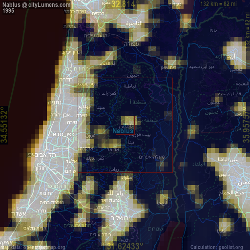
» NASA, Earths city lights 1995
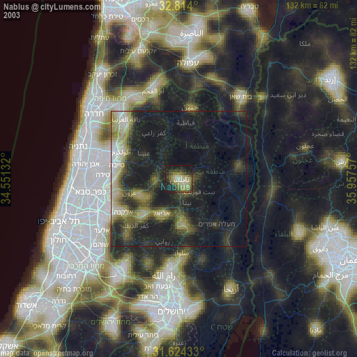
» NASA city lights 2003
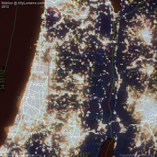
» Earth at Night: Flat Maps 2012, 2016