Jannātah night lights from space
Night Light of Jannātah (West Bank) from space (Palestinian Territory) Src. Average luminocity for 10x10km area is 63.6813% and for 50x50km: 42.5131%.
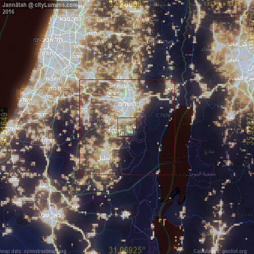
Analysis of Jannātah night lights 2016
Square area 10x10 km:
 8.97%
8.97%90-99
8.06%80-89
14.65%70-79
16.48%60-69
8.24%50-59
13.19%40-49
13.37%30-39
4.21%20-29
4.76%10-19
7.33%0-9
0.73%Square area 50x50 km:
7.68%90-99
7.4%80-89
7.68%70-79
8.73%60-69
4.35%50-59
6.9%40-49
7.37%30-39
5.7%20-29
6.3%10-19
7%0-9
30.89%Clear (daylight) street map image can be seen on geolist.org.
Map coordinates:
32° 15' 57.9" North, 34° 30' 59.4" East
31° 40' 10.5" North, 35° 13' 10.6" East
31° 4' 9.3" North, 35° 55' 21.9" East
Some cities around Jannātah sort by population:
• Bethlehem
4.2 km =2.6 mi,  339°
339°
• Bayt Jālā
5.9 km =3.7 mi,  329°
329°
• Bayt Sāḩūr
3.5 km =2.2 mi,  10°
10°
• Bayt Fajjār
7.9 km =4.9 mi,  230°
230°
• Efrata
6.8 km =4.2 mi,  254°
254°
• Ad Dawḩah
5 km =3.1 mi,  311°
311°
• Al Khaḑir
5.7 km =3.5 mi,  298°
298°
• Za‘tarah
3.5 km =2.2 mi,  82°
82°
283133 (p: 5,348)
Sources (retrieved 2019-11-25):
» Earth at Night: Flat Maps 2012, 2016