Al ‘Ubaydīyah night lights from space
Night Light of Al ‘Ubaydīyah from space (Palestinian Territory) Src. Average luminocity for 10x10km area is 41.6703% and for 50x50km: 38.5522%.
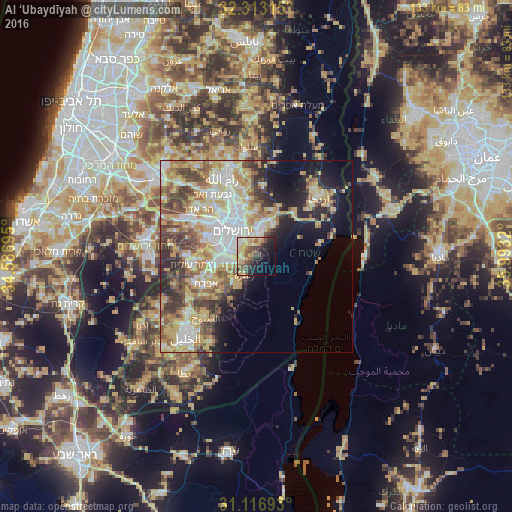
Analysis of Al ‘Ubaydīyah night lights 2016
Square area 10x10 km:
 2.93%
2.93%90-99
5.49%80-89
11.36%70-79
6.41%60-69
5.68%50-59
7.14%40-49
9.34%30-39
4.4%20-29
11.17%10-19
18.5%0-9
17.58%Square area 50x50 km:
7.39%90-99
7.22%80-89
6.8%70-79
7.9%60-69
3.83%50-59
5.34%40-49
5.59%30-39
4.7%20-29
5.13%10-19
8.48%0-9
37.62%Clear (daylight) street map image can be seen on geolist.org.
Map coordinates:
32° 18' 47.3" North, 34° 35' 13" East
31° 43' 1.1" North, 35° 17' 24.3" East
31° 7' 0.9" North, 35° 59' 35.5" East
Some cities around Al ‘Ubaydīyah sort by population:
• Jerusalem, IL
9.1 km =5.7 mi,  309°
309°
• Old City
8.5 km =5.3 mi,  321°
321°
• Bethlehem
8.3 km =5.2 mi,  260°
260°
• Al ‘Ayzarīyah
6.3 km =3.9 mi,  341°
341°
• Bayt Sāḩūr
6.3 km =3.9 mi,  253°
253°
• Abū Dīs
5.7 km =3.5 mi,  331°
331°
• Za‘tarah
5.8 km =3.6 mi,  213°
213°
• Jannātah
8.5 km =5.3 mi,  231°
231°
7890350 (p: 10,618)
Sources (retrieved 2019-11-25):
» Earth at Night: Flat Maps 2012, 2016