Złotniki night lights from space
Night Light of Złotniki (Lower Silesia) from space (Poland) Src. Average luminocity for 10x10km area is 51.4452% and for 50x50km: 15.3955%.
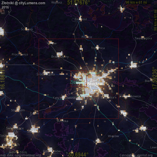
Analysis of Złotniki night lights 2016
Square area 10x10 km:
 13.64%
90-99
15.11%80-89
3.48%70-79
7.09%60-69
3.34%50-59
4.68%40-49
4.55%30-39
8.29%20-29
10.29%10-19
16.04%0-9
13.5%Square area 50x50 km:
3.99%90-99
3.59%80-89
1.12%70-79
1.25%60-69
1.36%50-59
1.49%40-49
1.76%30-39
2.02%20-29
3.64%10-19
6.51%0-9
73.27%Clear (daylight) street map image can be seen on geolist.org.
Map coordinates:
51° 34' 36.3" North, 16° 11' 10" East
51° 8' 15.7" North, 16° 53' 21.2" East
50° 41' 39.8" North, 17° 35' 32.5" East
Some cities around Złotniki sort by population:
• Osiedle Kosmonautów
5.2 km =3.2 mi,  102°
102°
• Kozanów
5.6 km =3.5 mi,  82°
82°
• Stabłowice
1.9 km =1.2 mi,  23°
23°
• Grabiszynek
8.8 km =5.5 mi,  129°
129°
• Leśnica-Ratyń-Pustki
2.9 km =1.8 mi,  279°
279°
• Gądów Mały
7.1 km =4.4 mi,  107°
107°
• Maślice Małe
3.9 km =2.4 mi,  70°
70°
• Pilczyce
4.8 km =3 mi,  90°
90°
12047637 (p: 5,373)
Sources (retrieved 2019-11-25):
» Earth at Night: Flat Maps 2012, 2016