Leśnica-Ratyń-Pustki night lights from space
Night Light of Leśnica-Ratyń-Pustki (Lower Silesia) from space (Poland) Src. Average luminocity for 10x10km area is 28.754% and for 50x50km: 15.1898%.
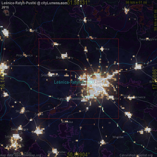
Analysis of Leśnica-Ratyń-Pustki night lights 2016
Square area 10x10 km:
 5.75%
5.75%90-99
6.15%80-89
1.07%70-79
5.21%60-69
1.74%50-59
3.07%40-49
3.61%30-39
6.82%20-29
7.75%10-19
17.51%0-9
41.31%Square area 50x50 km:
3.98%90-99
3.59%80-89
1.09%70-79
1.3%60-69
1.27%50-59
1.43%40-49
1.77%30-39
1.99%20-29
3.66%10-19
6.32%0-9
73.61%Clear (daylight) street map image can be seen on geolist.org.
Map coordinates:
51° 34' 52.7" North, 16° 8' 40.6" East
51° 8' 32.2" North, 16° 50' 51.8" East
50° 41' 56.5" North, 17° 33' 3.1" East
Some cities around Leśnica-Ratyń-Pustki sort by population:
• Osiedle Kosmonautów
8.1 km =5 mi,  101°
101°
• Kozanów
8.5 km =5.3 mi,  88°
88°
• Stabłowice
3.9 km =2.4 mi,  70°
70°
• Grabiszynek
11.5 km =7.1 mi,  122°
122°
• Gądów Mały
10 km =6.2 mi,  105°
105°
• Maślice Małe
6.6 km =4.1 mi,  83°
83°
• Pilczyce
7.7 km =4.8 mi, 94°
• Złotniki
2.9 km =1.8 mi, 99°
12047615 (p: 8,724)
Sources (retrieved 2019-11-25):
» Earth at Night: Flat Maps 2012, 2016