Targówek night lights from space
Night Light of Targówek (Mazovia) from space (Poland) Src. Average luminocity for 10x10km area is 95.923% and for 50x50km: 41.517%.
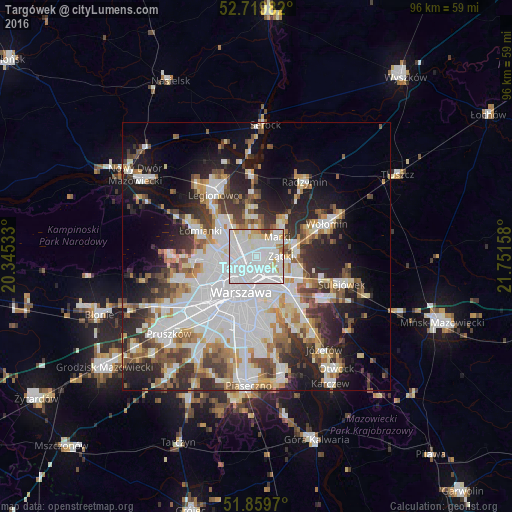
Analysis of Targówek night lights 2016
Square area 10x10 km:
 62.88%
90-99
23.74%80-89
6.31%70-79
3.28%60-69
2.02%50-59
0.13%40-49
1.64%30-39
0%20-29
0%10-19
0%0-9
0%Square area 50x50 km:
13.82%90-99
9.01%80-89
3.5%70-79
3.77%60-69
4.19%50-59
4.41%40-49
4.37%30-39
4.92%20-29
8.09%10-19
11.97%0-9
31.94%Clear (daylight) street map image can be seen on geolist.org.
Map coordinates:
52° 43' 11.4" North, 20° 20' 43.2" East
52° 17' 30.7" North, 21° 2' 54.4" East
51° 51' 34.9" North, 21° 45' 5.7" East
Some cities around Targówek sort by population:
• Praga Południe
5.9 km =3.7 mi,  154°
154°
• Wola
7 km =4.3 mi,  215°
215°
• Śródmieście
7.3 km =4.5 mi,  197°
197°
• Praga Północ
4.3 km =2.7 mi,  192°
192°
• Białołeka
6.1 km =3.8 mi,  302°
302°
• Żoliborz
4.9 km =3 mi,  238°
238°
• Ząbki
3.9 km =2.4 mi,  88°
88°
• Marki
5 km =3.1 mi,  50°
50°
757065 (p: 124,316)
Sources (retrieved 2019-11-25):
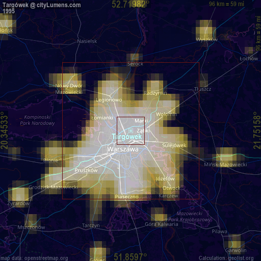
» NASA, Earths city lights 1995
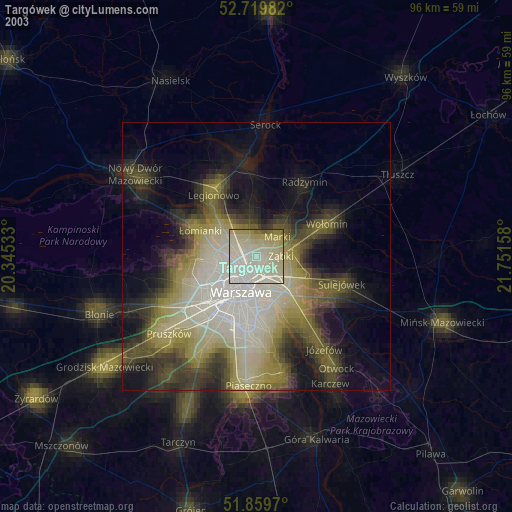
» NASA city lights 2003
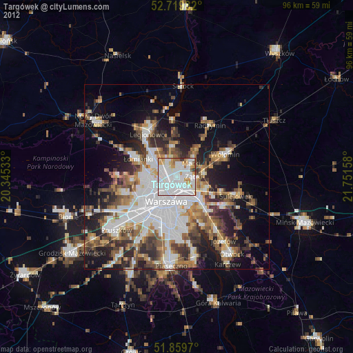
» Earth at Night: Flat Maps 2012, 2016