Tuchów night lights from space
Night Light of Tuchów (Lesser Poland) from space (Poland) Src. Average luminocity for 10x10km area is 4.3095% and for 50x50km: 5.9687%.
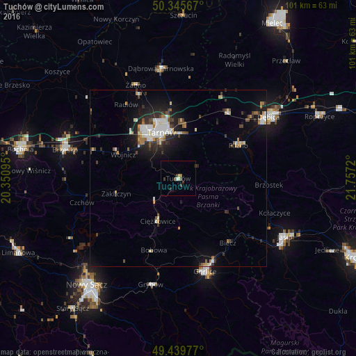
Analysis of Tuchów night lights 2016
Square area 10x10 km:
 0.28%
0.28%90-99
0.84%80-89
0%70-79
0.56%60-69
0.56%50-59
0%40-49
2.24%30-39
1.82%20-29
0.14%10-19
0%0-9
93.56%Square area 50x50 km:
0.95%90-99
1.14%80-89
0.52%70-79
0.51%60-69
0.61%50-59
0.57%40-49
0.85%30-39
0.85%20-29
1.62%10-19
4.26%0-9
88.11%Clear (daylight) street map image can be seen on geolist.org.
Map coordinates:
50° 20' 44.4" North, 20° 21' 3.4" East
49° 53' 41.5" North, 21° 3' 14.7" East
49° 26' 23.2" North, 21° 45' 25.9" East
Some cities around Tuchów sort by population:
• Tarnów
14.1 km =8.8 mi,  340°
340°
• Nowy Sącz
39.7 km =24.7 mi,  220°
220°
• Dębica
30.9 km =19.2 mi,  55°
55°
• Jasło
34.3 km =21.3 mi,  119°
119°
• Gorlice
27.7 km =17.2 mi,  163°
163°
• Brzesko
33.1 km =20.6 mi,  284°
284°
• Dąbrowa Tarnowska
31.5 km =19.6 mi,  351°
351°
• Grybów
31 km =19.3 mi,  194°
194°
756634 (p: 6,680)
Sources (retrieved 2019-11-25):
» Earth at Night: Flat Maps 2012, 2016