Grybów night lights from space
Night Light of Grybów (Lesser Poland) from space (Poland) Src. Average luminocity for 10x10km area is 3.3319% and for 50x50km: 4.3091%.
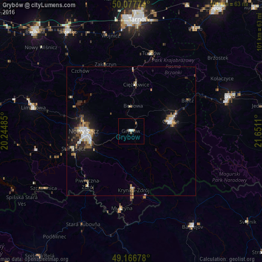
Analysis of Grybów night lights 2016
Square area 10x10 km:
 0.7%
0.7%90-99
0.98%80-89
0%70-79
0%60-69
0.84%50-59
0.56%40-49
0.56%30-39
0.28%20-29
0%10-19
0%0-9
96.08%Square area 50x50 km:
0.57%90-99
0.82%80-89
0.4%70-79
0.36%60-69
0.51%50-59
0.6%40-49
0.68%30-39
0.6%20-29
0.92%10-19
2.95%0-9
91.58%Clear (daylight) street map image can be seen on geolist.org.
Map coordinates:
50° 4' 39.9" North, 20° 14' 41.5" East
49° 37' 27.8" North, 20° 56' 52.7" East
49° 10' 0.4" North, 21° 39' 4" East
Some cities around Grybów sort by population:
• Nowy Sącz
18.1 km =11.2 mi,  269°
269°
• Gorlice
15.7 km =9.8 mi,  77°
77°
• Limanowa
38.9 km =24.2 mi,  283°
283°
• Krynica-Zdrój
22.5 km =14 mi,  177°
177°
• Stary Sącz
23.5 km =14.6 mi,  253°
253°
• Tuchów
31 km =19.3 mi,  14°
14°
• Piwniczna-Zdrój
26.5 km =16.5 mi,  219°
219°
• Muszyna
30 km =18.6 mi,  187°
187°
771313 (p: 5,994)
Sources (retrieved 2019-11-25):
» Earth at Night: Flat Maps 2012, 2016