Inowrocław night lights from space
Night Light of Inowrocław (Kujawsko-Pomorskie) from space (Poland) Src. Average luminocity for 10x10km area is 32.1919% and for 50x50km: 4.7001%.
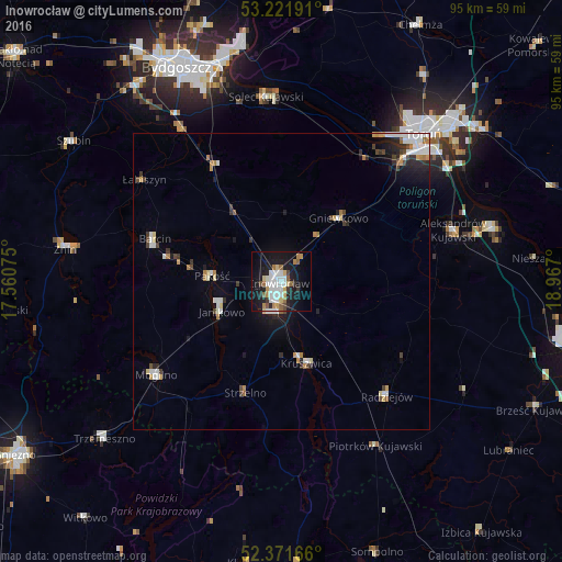
Analysis of Inowrocław night lights 2016
Square area 10x10 km:
 8.46%
8.46%90-99
6.19%80-89
3.41%70-79
2.65%60-69
3.54%50-59
3.28%40-49
2.02%30-39
1.52%20-29
5.81%10-19
33.08%0-9
30.05%Square area 50x50 km:
0.99%90-99
0.83%80-89
0.41%70-79
0.51%60-69
0.53%50-59
0.22%40-49
0.55%30-39
0.49%20-29
0.97%10-19
2.81%0-9
91.68%Clear (daylight) street map image can be seen on geolist.org.
Map coordinates:
53° 13' 18.9" North, 17° 33' 38.7" East
52° 47' 55.9" North, 18° 15' 49.9" East
52° 22' 18" North, 18° 58' 1.2" East
Some cities around Inowrocław sort by population:
• Mogilno
26 km =16.2 mi,  232°
232°
• Kruszwica
14.4 km =8.9 mi,  161°
161°
• Janikowo
11.3 km =7 mi,  243°
243°
• Barcin
22.6 km =14 mi,  289°
289°
• Gniewkowo
14.4 km =8.9 mi,  42°
42°
• Strzelno
20 km =12.4 mi,  197°
197°
• Pakość
12 km =7.5 mi,  271°
271°
• Radziejów
26.3 km =16.3 mi,  137°
137°
3097872 (p: 77,597)
Sources (retrieved 2019-11-25):
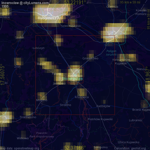
» NASA, Earths city lights 1995
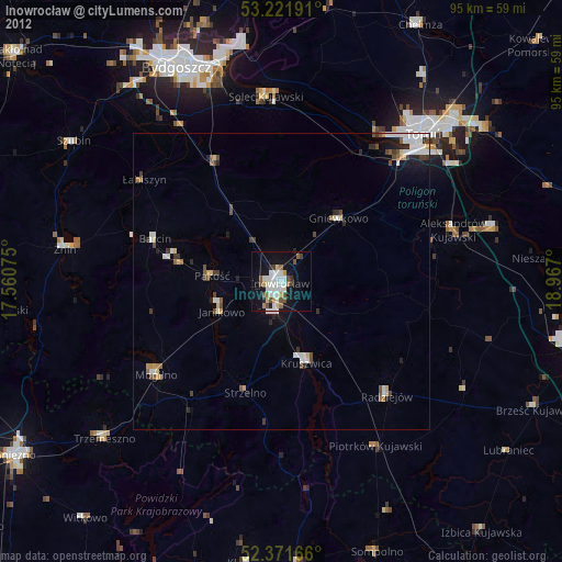
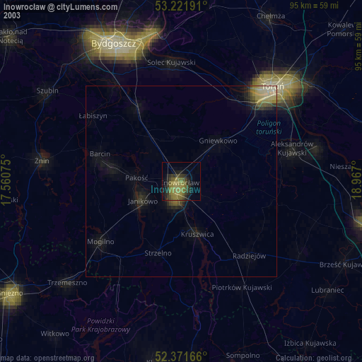
» NASA city lights 2003
» Earth at Night: Flat Maps 2012, 2016